Skip to content
Pause slideshow
Play slideshow
Free worldwide shipping on river map wall art
Free shipping on all globes in the EU
instagram
Instagram
Facebook
LinkedIn
Language
English
English
日本語
Русский
العربية
Español
Português (brasil)
Italiano
Français
Deutsch
简体中文
हिन्दी
Currency
United States (USD $)
Afghanistan (AFN ؋)
Åland Islands (EUR €)
Albania (ALL L)
Algeria (DZD د.ج)
Andorra (EUR €)
Angola (USD $)
Anguilla (XCD $)
Antigua & Barbuda (XCD $)
Argentina (USD $)
Armenia (AMD դր.)
Aruba (AWG ƒ)
Ascension Island (SHP £)
Australia (AUD $)
Austria (EUR €)
Azerbaijan (AZN ₼)
Bahamas (BSD $)
Bahrain (USD $)
Bangladesh (BDT ৳)
Barbados (BBD $)
Belarus (USD $)
Belgium (EUR €)
Belize (BZD $)
Benin (XOF Fr)
Bermuda (USD $)
Bhutan (USD $)
Bolivia (BOB Bs.)
Bosnia & Herzegovina (BAM КМ)
Botswana (BWP P)
Brazil (USD $)
British Indian Ocean Territory (USD $)
British Virgin Islands (USD $)
Brunei (BND $)
Bulgaria (EUR €)
Burkina Faso (XOF Fr)
Burundi (BIF Fr)
Cambodia (KHR ៛)
Cameroon (XAF CFA)
Canada (CAD $)
Cape Verde (CVE $)
Caribbean Netherlands (USD $)
Cayman Islands (KYD $)
Central African Republic (XAF CFA)
Chad (XAF CFA)
Chile (USD $)
China (CNY ¥)
Christmas Island (AUD $)
Cocos (Keeling) Islands (AUD $)
Colombia (USD $)
Comoros (KMF Fr)
Congo - Brazzaville (XAF CFA)
Congo - Kinshasa (CDF Fr)
Cook Islands (NZD $)
Costa Rica (CRC ₡)
Côte d’Ivoire (XOF Fr)
Croatia (EUR €)
Curaçao (ANG ƒ)
Cyprus (EUR €)
Czechia (CZK Kč)
Denmark (DKK kr.)
Djibouti (DJF Fdj)
Dominica (XCD $)
Dominican Republic (DOP $)
Ecuador (USD $)
Egypt (EGP ج.م)
El Salvador (USD $)
Equatorial Guinea (XAF CFA)
Eritrea (USD $)
Estonia (EUR €)
Eswatini (USD $)
Ethiopia (ETB Br)
Falkland Islands (FKP £)
Faroe Islands (DKK kr.)
Fiji (FJD $)
Finland (EUR €)
France (EUR €)
French Guiana (EUR €)
French Polynesia (XPF Fr)
French Southern Territories (EUR €)
Gabon (XOF Fr)
Gambia (GMD D)
Georgia (USD $)
Germany (EUR €)
Ghana (USD $)
Gibraltar (GBP £)
Greece (EUR €)
Greenland (DKK kr.)
Grenada (XCD $)
Guadeloupe (EUR €)
Guatemala (GTQ Q)
Guernsey (GBP £)
Guinea (GNF Fr)
Guinea-Bissau (XOF Fr)
Guyana (GYD $)
Haiti (USD $)
Honduras (HNL L)
Hong Kong SAR (HKD $)
Hungary (HUF Ft)
Iceland (ISK kr)
India (INR ₹)
Indonesia (IDR Rp)
Iraq (USD $)
Ireland (EUR €)
Isle of Man (GBP £)
Israel (ILS ₪)
Italy (EUR €)
Jamaica (JMD $)
Japan (JPY ¥)
Jersey (USD $)
Jordan (USD $)
Kazakhstan (KZT ₸)
Kenya (KES KSh)
Kiribati (USD $)
Kosovo (EUR €)
Kuwait (USD $)
Kyrgyzstan (KGS som)
Laos (LAK ₭)
Latvia (EUR €)
Lebanon (LBP ل.ل)
Lesotho (USD $)
Liberia (USD $)
Libya (USD $)
Liechtenstein (CHF CHF)
Lithuania (EUR €)
Luxembourg (EUR €)
Macao SAR (MOP P)
Madagascar (USD $)
Malawi (MWK MK)
Malaysia (MYR RM)
Maldives (MVR MVR)
Mali (XOF Fr)
Malta (EUR €)
Martinique (EUR €)
Mauritania (USD $)
Mauritius (MUR ₨)
Mayotte (EUR €)
Mexico (USD $)
Moldova (MDL L)
Monaco (EUR €)
Mongolia (MNT ₮)
Montenegro (EUR €)
Montserrat (XCD $)
Morocco (MAD د.م.)
Mozambique (USD $)
Myanmar (Burma) (MMK K)
Namibia (USD $)
Nauru (AUD $)
Nepal (NPR Rs.)
Netherlands (EUR €)
New Caledonia (XPF Fr)
New Zealand (NZD $)
Nicaragua (NIO C$)
Niger (XOF Fr)
Nigeria (NGN ₦)
Niue (NZD $)
Norfolk Island (AUD $)
North Macedonia (MKD ден)
Norway (USD $)
Oman (USD $)
Pakistan (PKR ₨)
Palestinian Territories (ILS ₪)
Panama (USD $)
Papua New Guinea (PGK K)
Paraguay (PYG ₲)
Peru (PEN S/)
Philippines (PHP ₱)
Pitcairn Islands (NZD $)
Poland (PLN zł)
Portugal (EUR €)
Qatar (QAR ر.ق)
Réunion (EUR €)
Romania (RON Lei)
Russia (USD $)
Rwanda (RWF FRw)
Samoa (WST T)
San Marino (EUR €)
São Tomé & Príncipe (STD Db)
Saudi Arabia (SAR ر.س)
Senegal (XOF Fr)
Serbia (RSD РСД)
Seychelles (USD $)
Sierra Leone (SLL Le)
Singapore (SGD $)
Sint Maarten (ANG ƒ)
Slovakia (EUR €)
Slovenia (EUR €)
Solomon Islands (SBD $)
Somalia (USD $)
South Africa (USD $)
South Georgia & South Sandwich Islands (GBP £)
South Korea (KRW ₩)
South Sudan (USD $)
Spain (EUR €)
Sri Lanka (LKR ₨)
St. Barthélemy (EUR €)
St. Helena (SHP £)
St. Kitts & Nevis (XCD $)
St. Lucia (XCD $)
St. Martin (EUR €)
St. Pierre & Miquelon (EUR €)
St. Vincent & Grenadines (XCD $)
Sudan (USD $)
Suriname (USD $)
Svalbard & Jan Mayen (USD $)
Sweden (SEK kr)
Switzerland (CHF CHF)
Taiwan (TWD $)
Tajikistan (TJS ЅМ)
Tanzania (TZS Sh)
Thailand (THB ฿)
Timor-Leste (USD $)
Togo (XOF Fr)
Tokelau (NZD $)
Tonga (TOP T$)
Trinidad & Tobago (TTD $)
Tristan da Cunha (GBP £)
Tunisia (USD $)
Türkiye (USD $)
Turkmenistan (USD $)
Turks & Caicos Islands (USD $)
Tuvalu (AUD $)
U.S. Outlying Islands (USD $)
Uganda (UGX USh)
Ukraine (UAH ₴)
United Arab Emirates (AED د.إ)
United Kingdom (GBP £)
United States (USD $)
Uruguay (UYU $U)
Uzbekistan (UZS so'm)
Vanuatu (VUV Vt)
Vatican City (EUR €)
Venezuela (USD $)
Vietnam (VND ₫)
Wallis & Futuna (XPF Fr)
Western Sahara (MAD د.م.)
Yemen (YER ﷼)
Zambia (USD $)
Zimbabwe (USD $)
Grasshopper Geography
Map Shop
Map styles
River basin maps
Ocean drainage basin maps
Forest maps
Elevation maps
Population maps
Continents
Africa
Asia
Australia and Oceania
Europe
North America
South America
Subdivisions
US states
Canadian provinces and territories
Australian states and territories
The UK and Ireland
Islands
Custom regions
Countries A-Z
A-F
G-L
M-R
S-Z
Gift Card
Quick shop
Add to cart
free shipping
United States - River basin map, rainbow colours - Wall Art
19 reviews
from
$44
00
from
$44.00
"Close (esc)"
Globes
Things we do
Custom work
Licensing
Wholesale
Collaborations
Exhibitions
Photography
About
About us
Blog
Sustainability
Testimonials
Press
Contact us
FAQ
Search
Search
Search
Account
0
Cart
.
.
.
Site navigation
Close
Search
Search
Cancel
Search
Search
Add order note
Close
Your cart is currently empty.
Map Shop
icon-chevron
Expand submenu
Map Shop
View all
icon-chevron
Map styles
icon-chevron
Expand submenu
Map styles
View all
icon-chevron
River basin maps
icon-chevron
Ocean drainage basin maps
icon-chevron
Forest maps
icon-chevron
Elevation maps
icon-chevron
Population maps
icon-chevron
Continents
icon-chevron
Expand submenu
Continents
Africa
icon-chevron
Asia
icon-chevron
Australia and Oceania
icon-chevron
Europe
icon-chevron
North America
icon-chevron
South America
icon-chevron
Subdivisions
icon-chevron
Expand submenu
Subdivisions
US states
icon-chevron
Canadian provinces and territories
icon-chevron
Australian states and territories
icon-chevron
The UK and Ireland
icon-chevron
Islands
icon-chevron
Custom regions
icon-chevron
Countries A-Z
icon-chevron
Expand submenu
Countries A-Z
View all
icon-chevron
A-F
icon-chevron
G-L
icon-chevron
M-R
icon-chevron
S-Z
icon-chevron
Gift Card
icon-chevron
Globes
icon-chevron
Things we do
icon-chevron
Expand submenu
Things we do
Custom work
icon-chevron
Licensing
icon-chevron
Wholesale
icon-chevron
Collaborations
icon-chevron
Exhibitions
icon-chevron
Photography
icon-chevron
About
icon-chevron
Expand submenu
About
About us
icon-chevron
Blog
icon-chevron
Sustainability
icon-chevron
Testimonials
icon-chevron
Press
icon-chevron
Contact us
icon-chevron
FAQ
icon-chevron
Home
/
Collections
/
Population maps
61 products
Sort
Featured
Most relevant
Best selling
Alphabetically, A-Z
Alphabetically, Z-A
Price, low to high
Price, high to low
Date, old to new
Date, new to old
Region
Continents
(5)
Countries
(33)
Country subdivisions
(9)
Custom regions
(7)
Islands
(7)
World maps
(3)
Continent
Africa
(5)
Asia
(15)
Australia and Oceania
(3)
Europe
(20)
North America
(14)
South America
(4)
Map style
Population map
(59)
Background colour
Black background
(59)
Orientation
Landscape
(23)
Portrait
(13)
Square
(23)
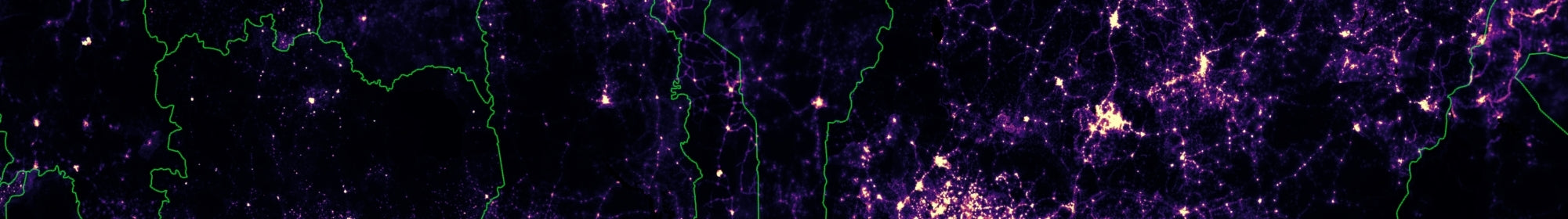
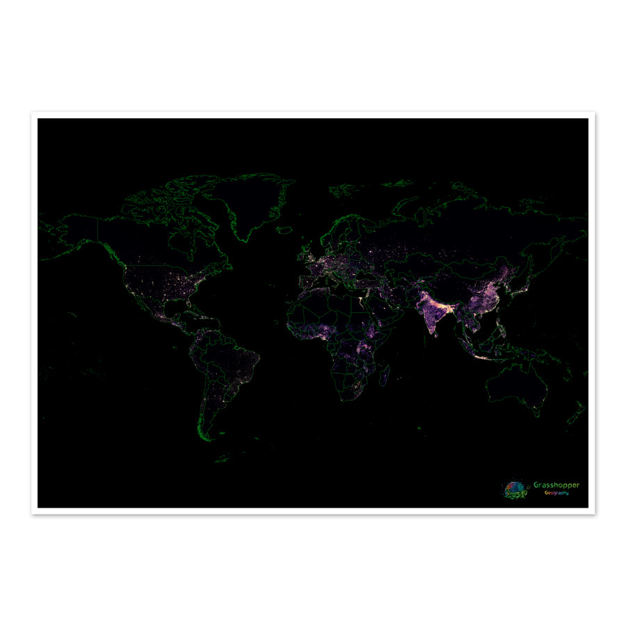
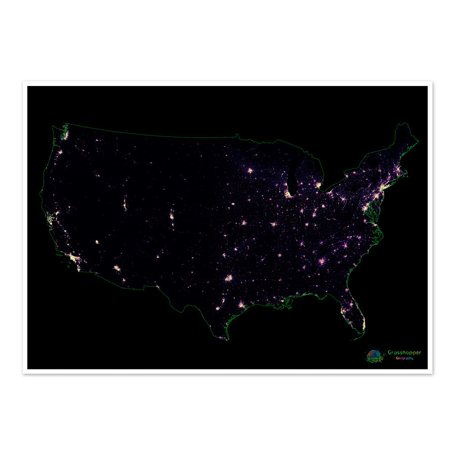
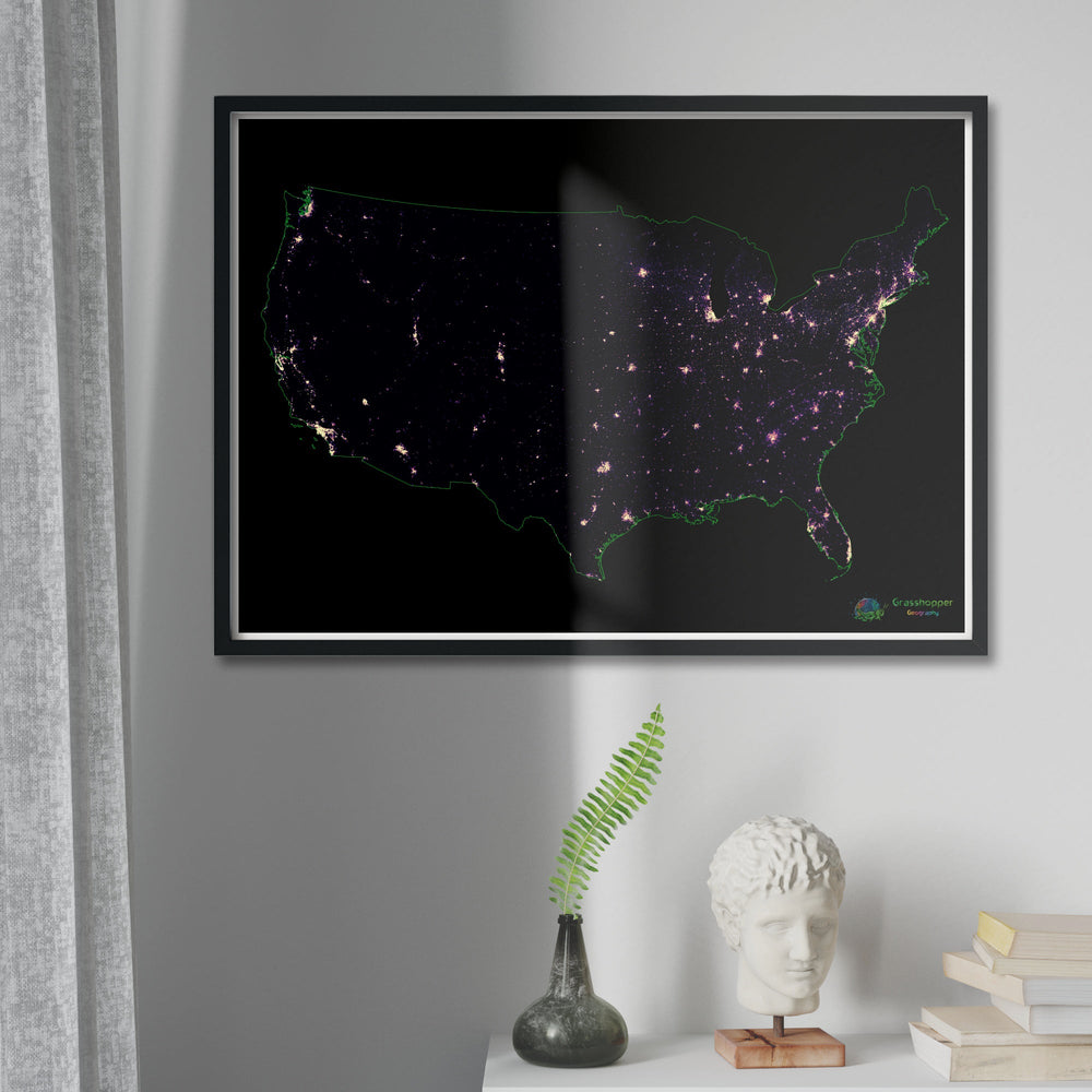
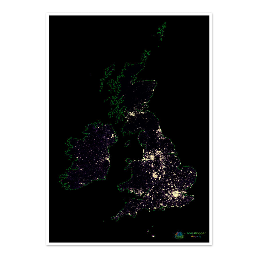
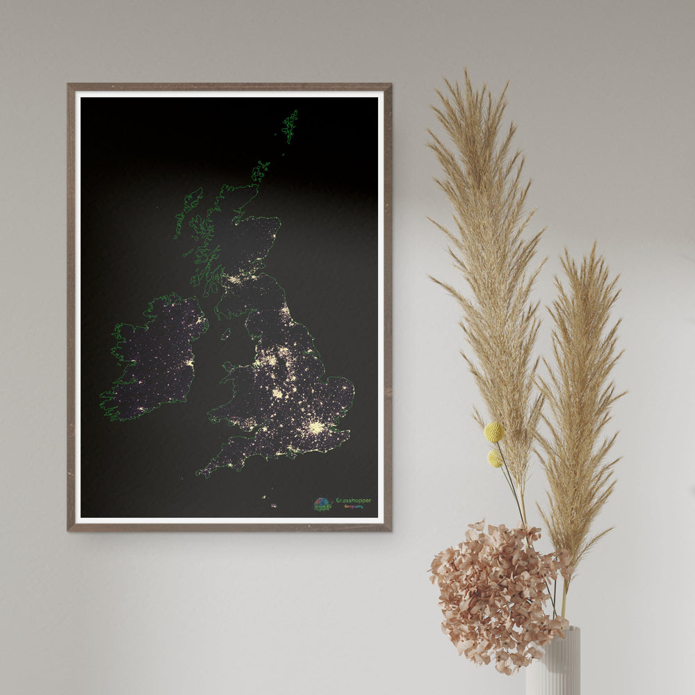
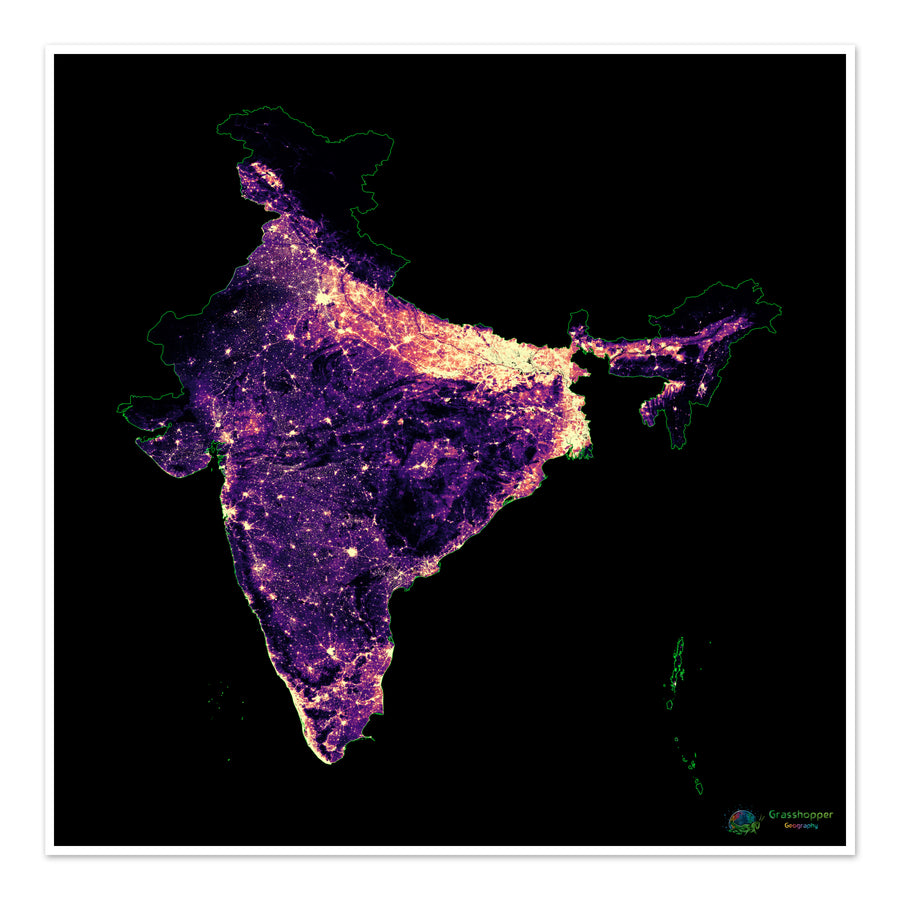
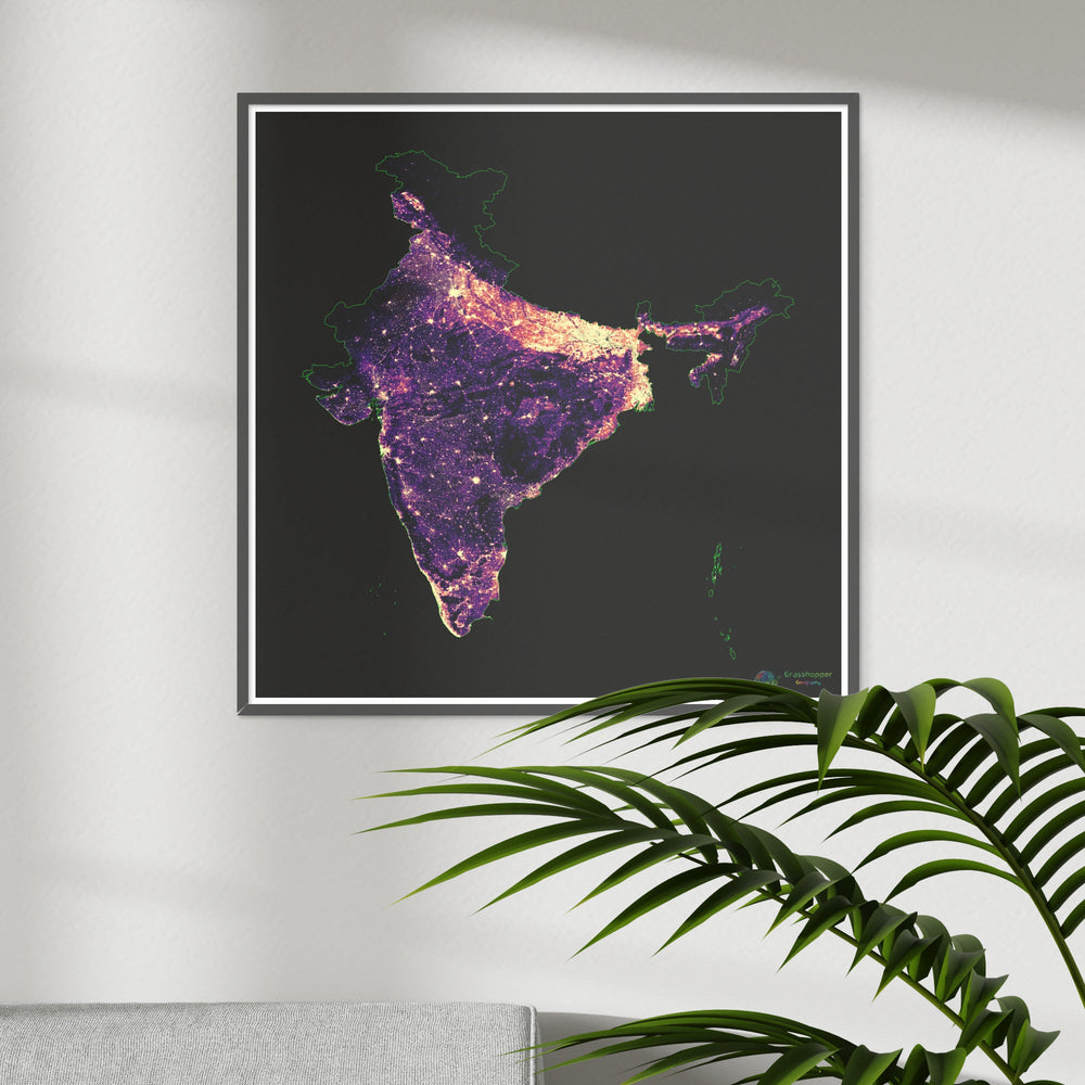
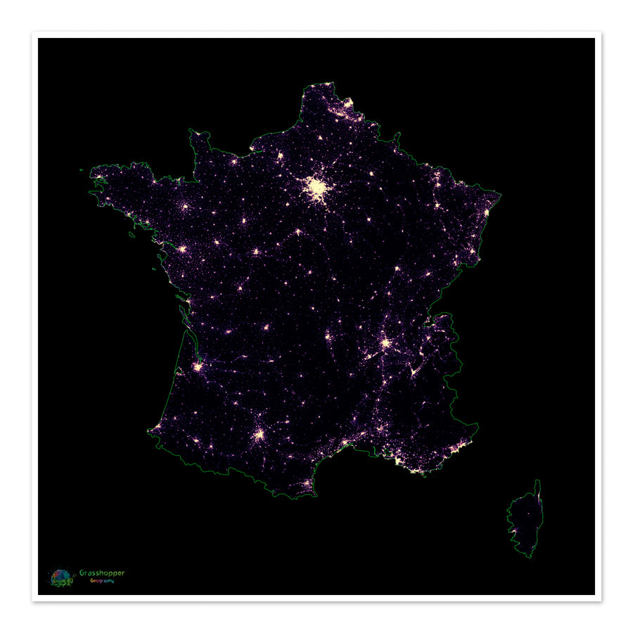
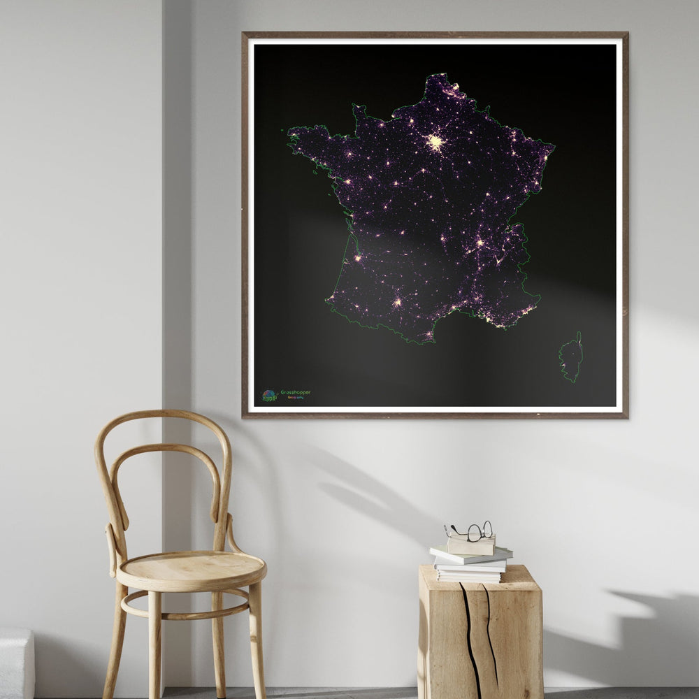
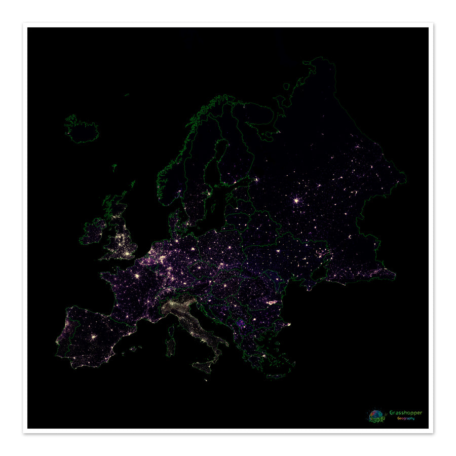
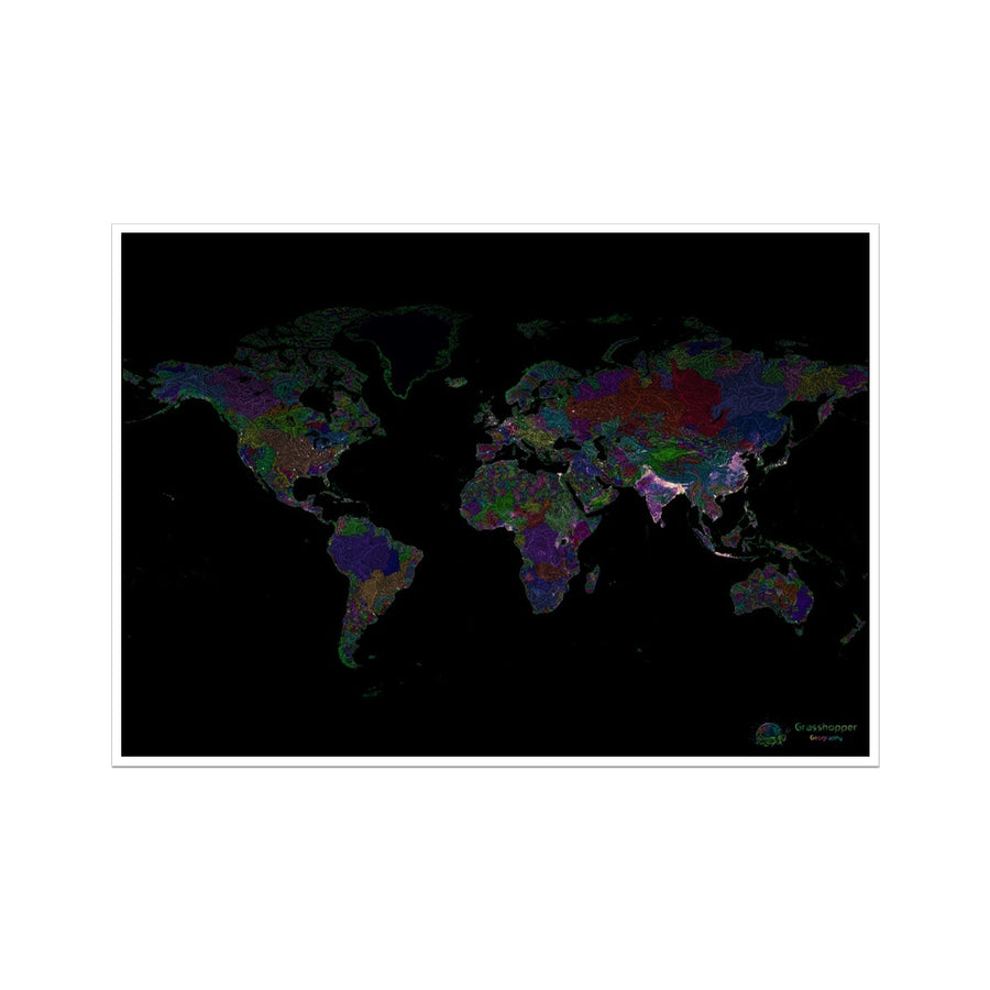
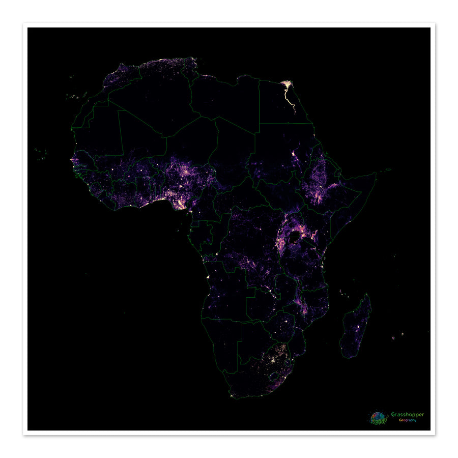
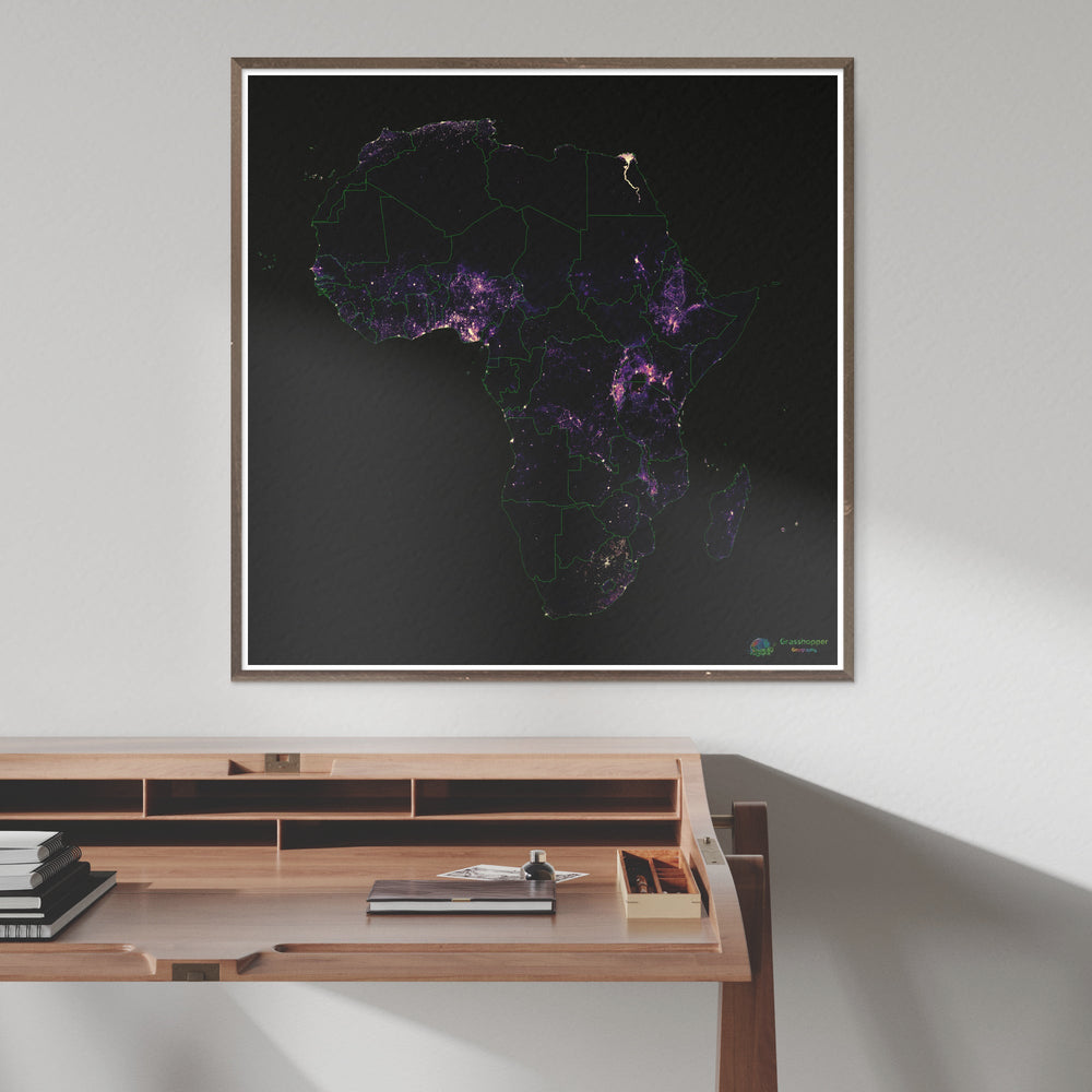
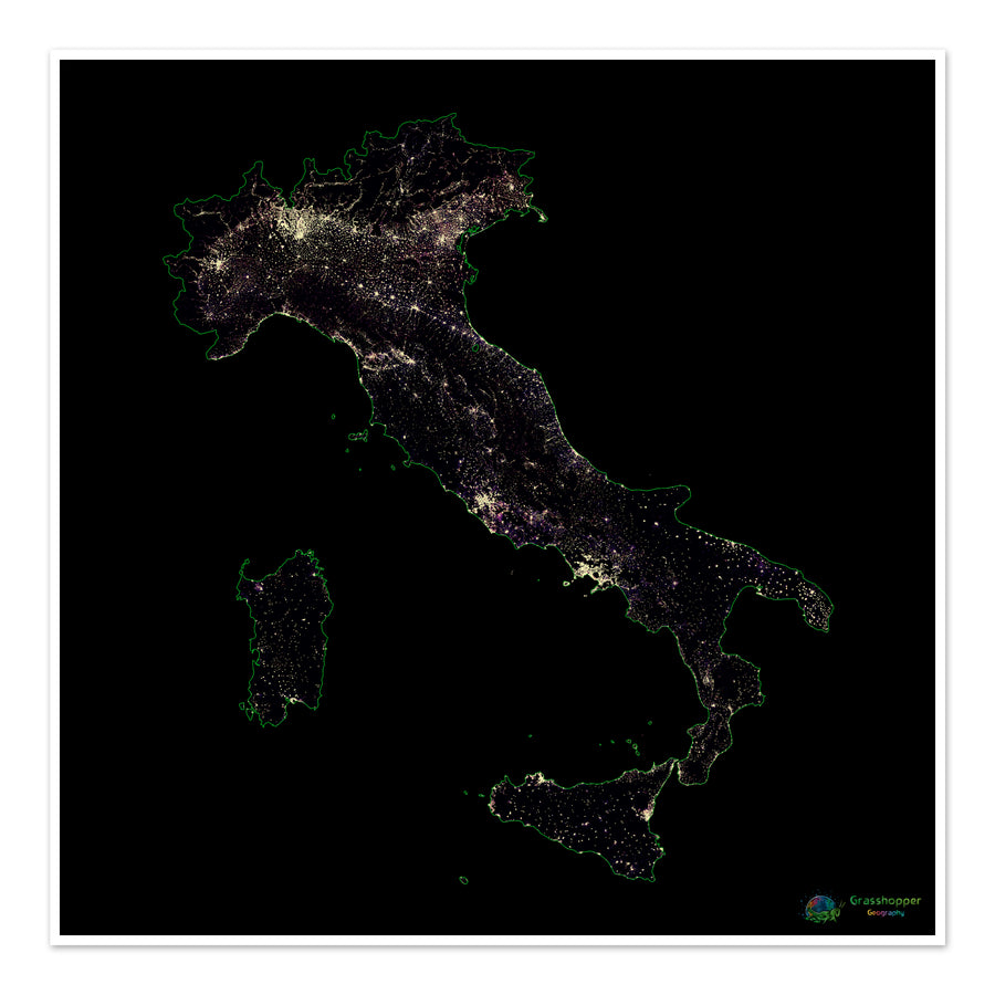
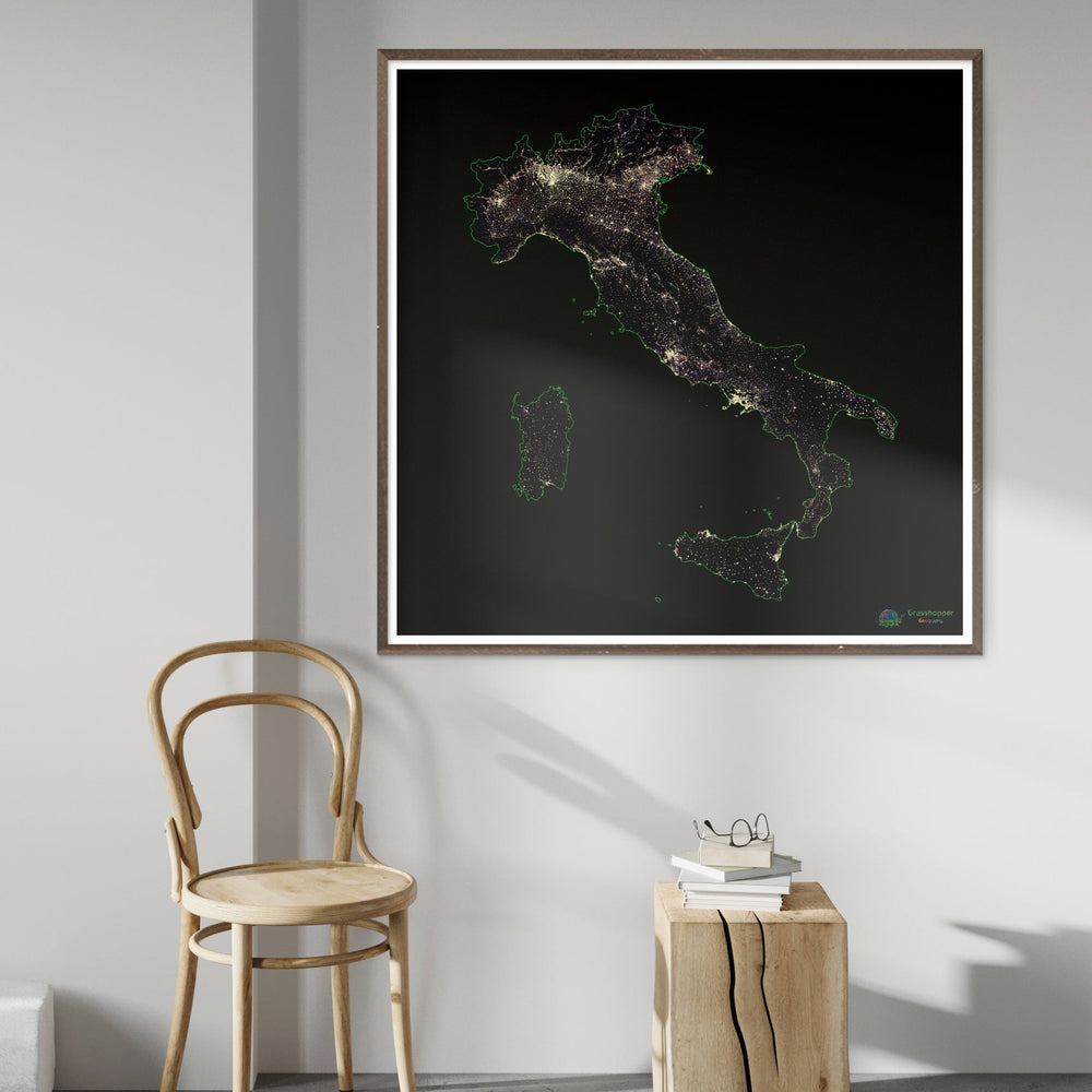
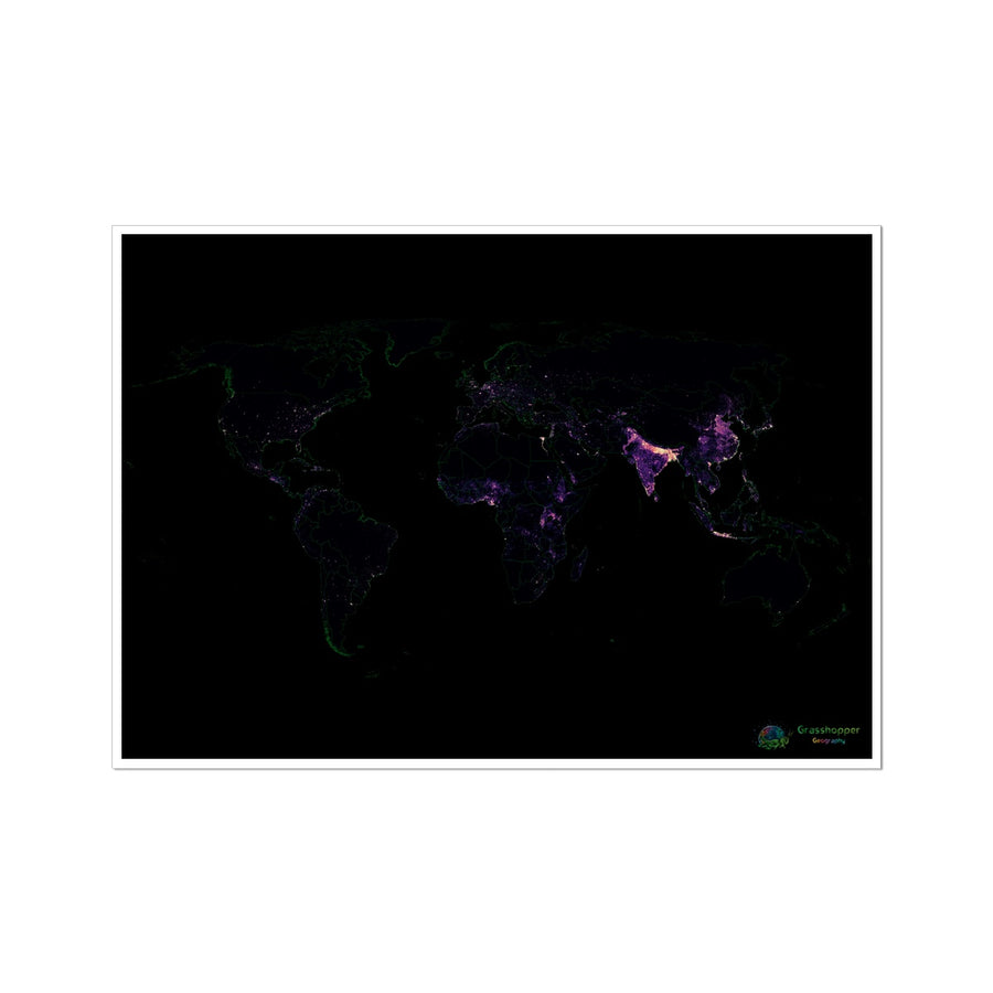
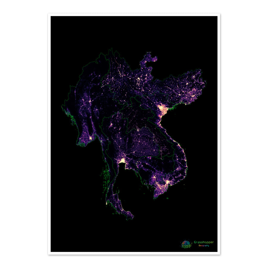
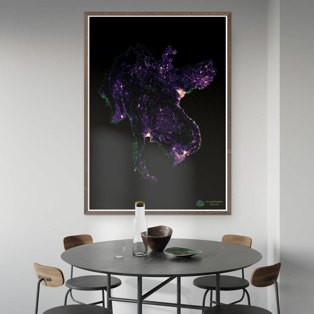
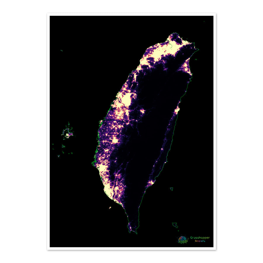
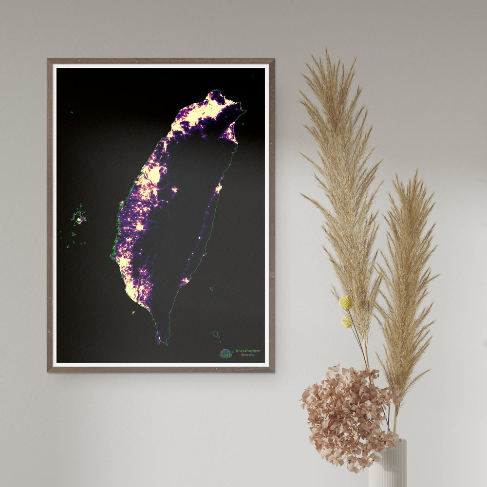
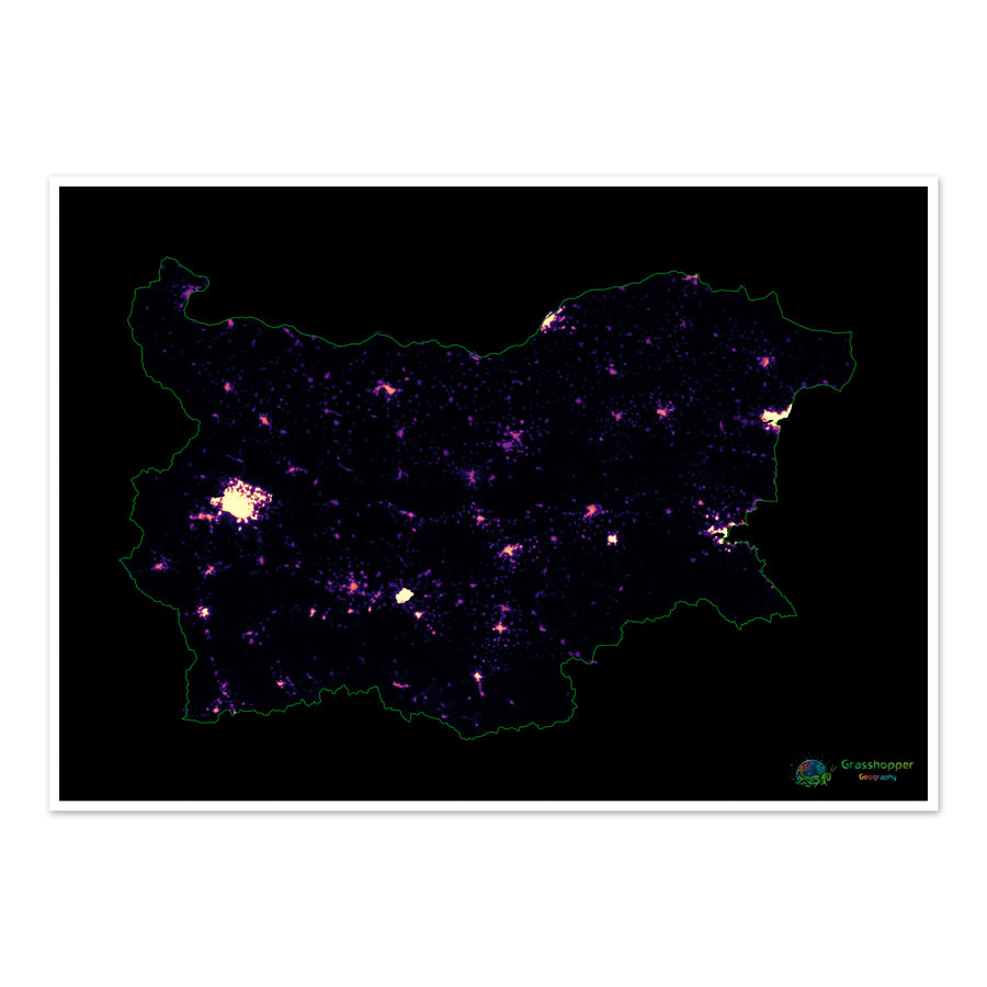
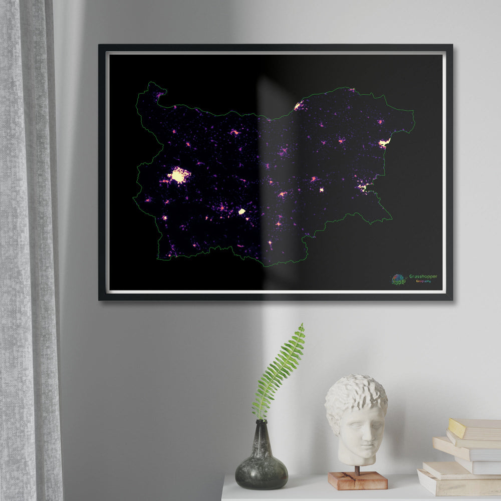
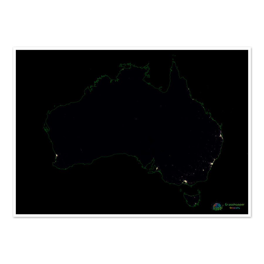
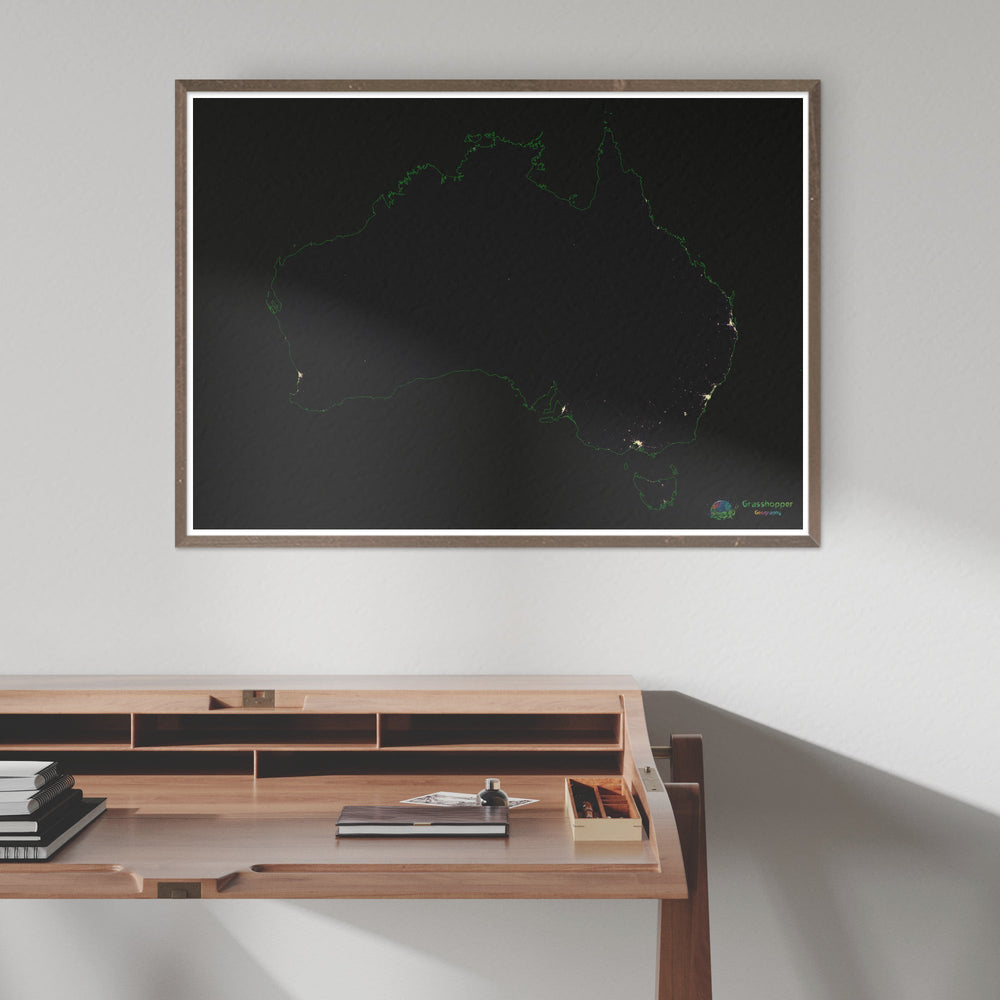
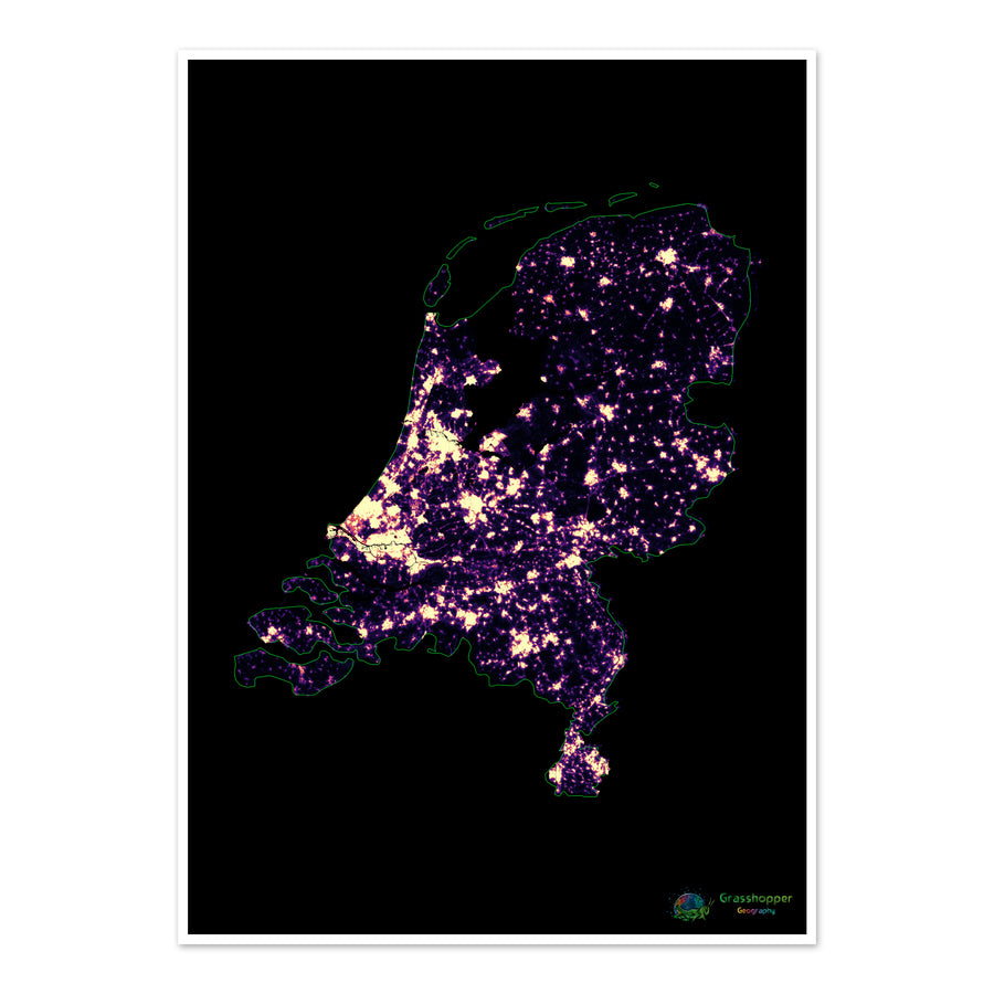
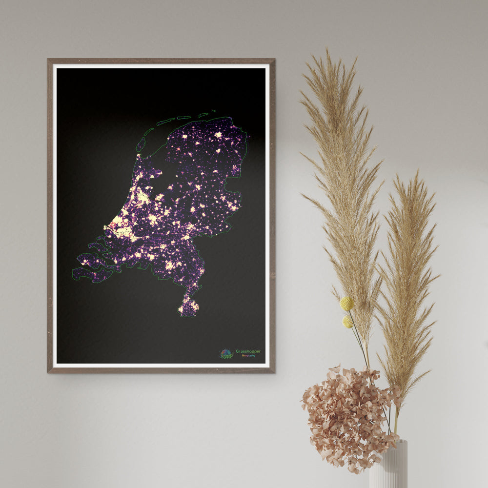
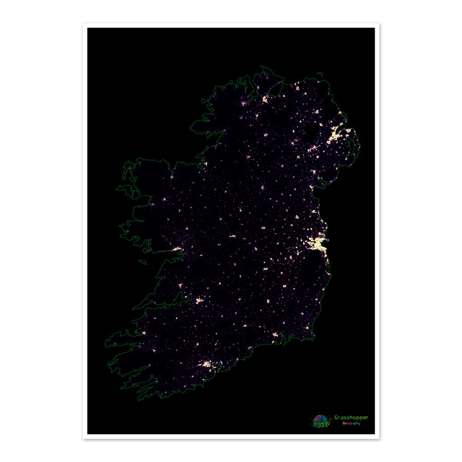
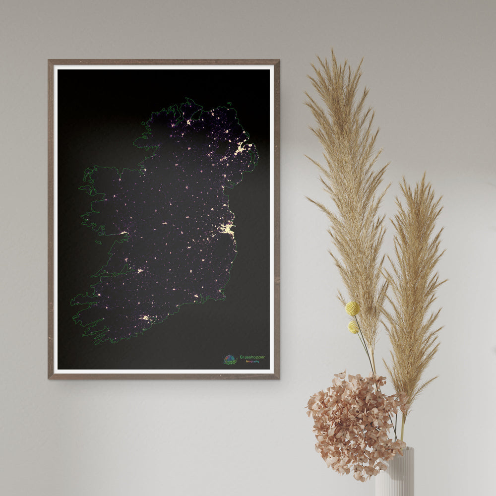
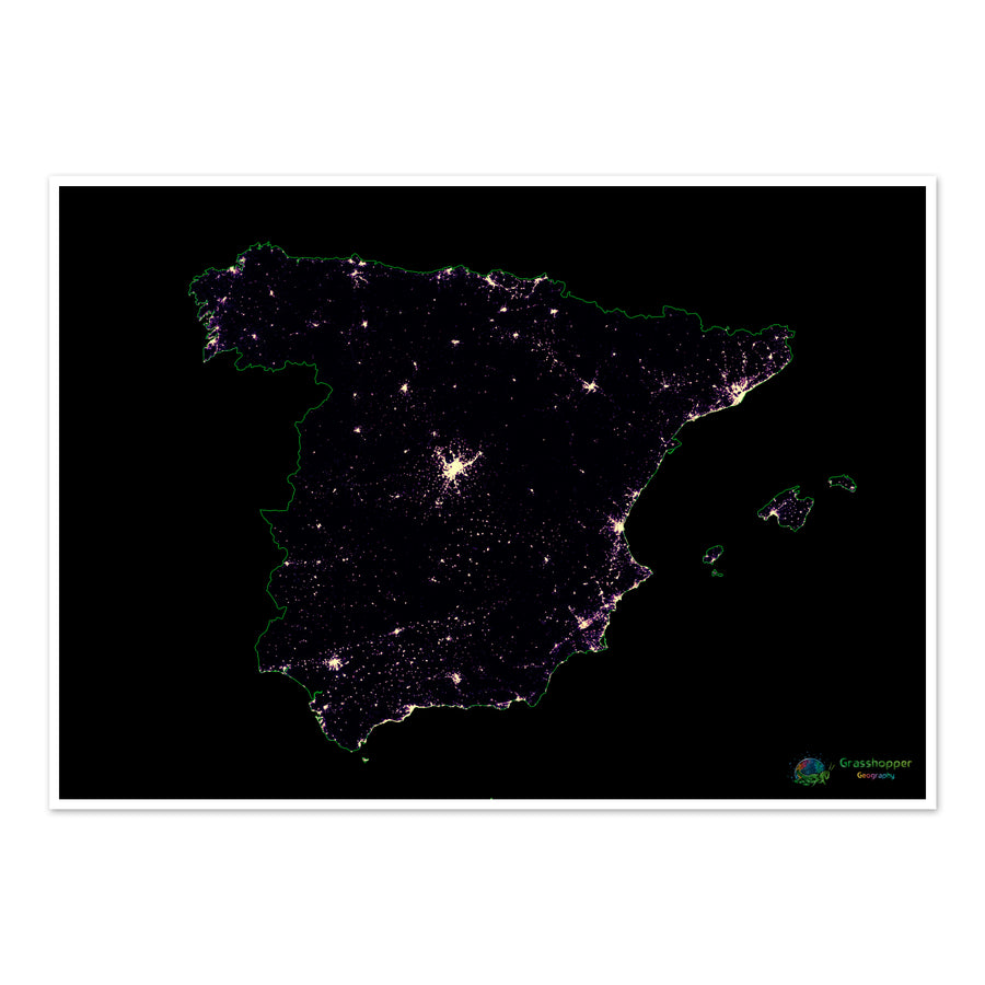
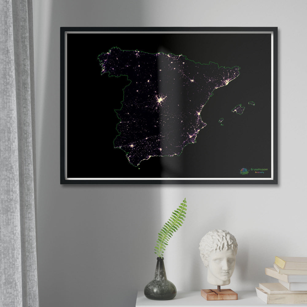
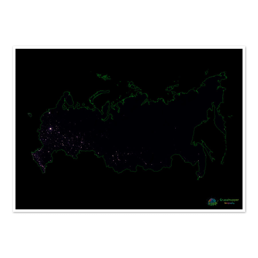
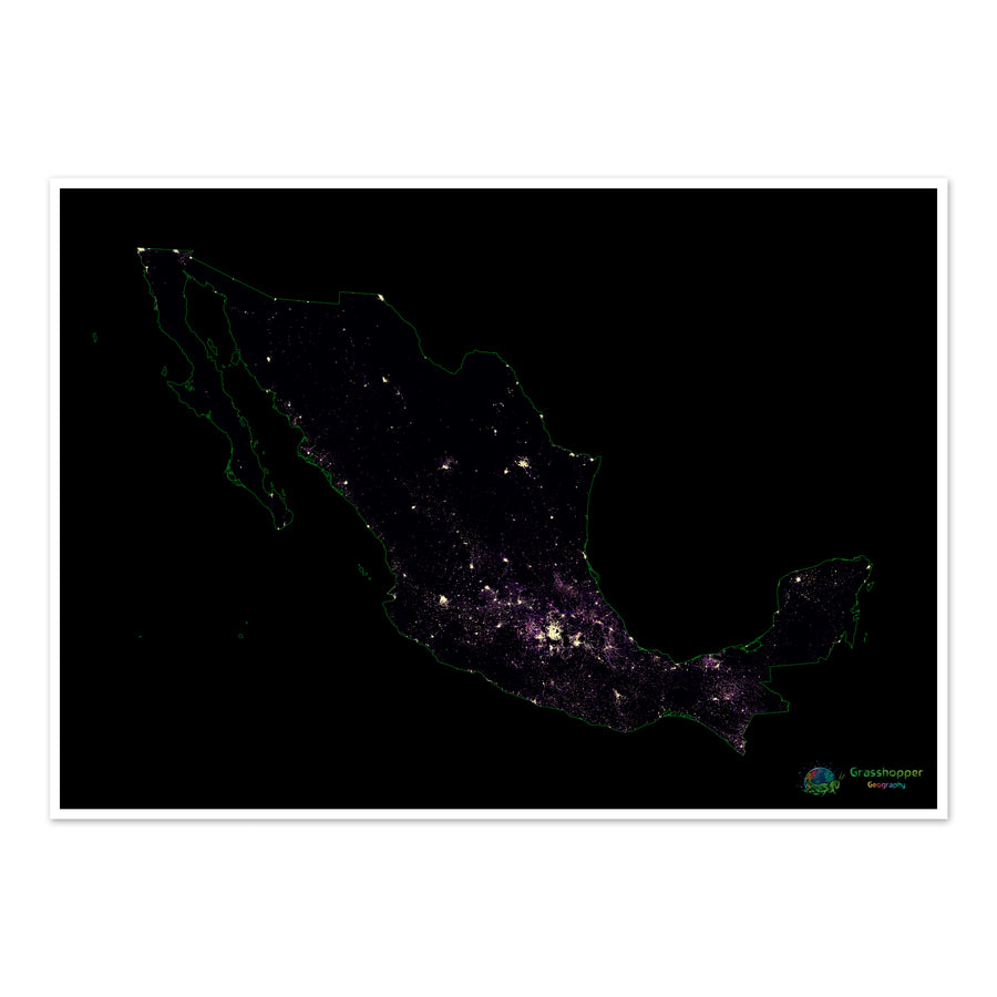
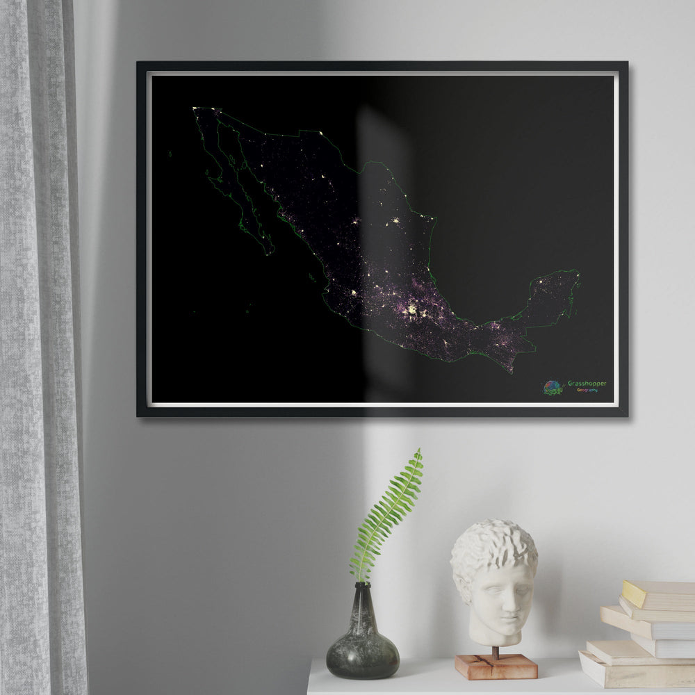
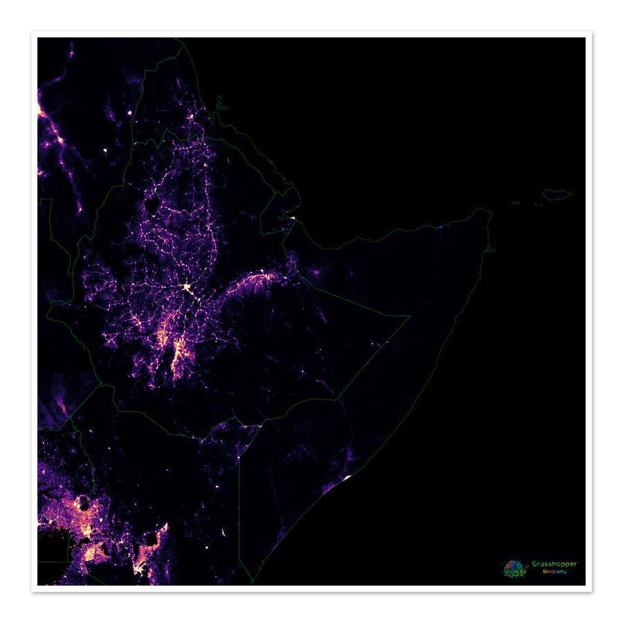
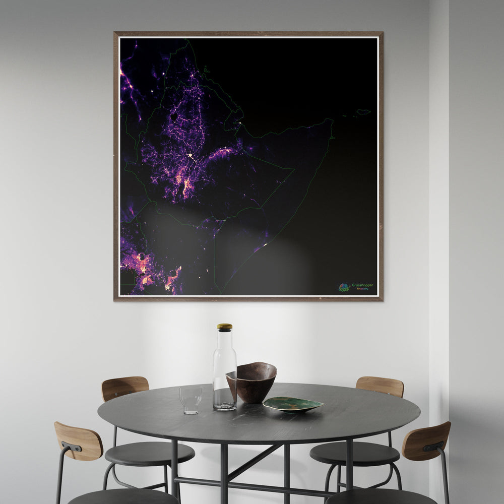
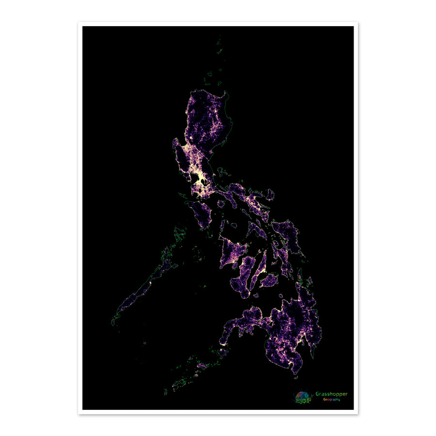
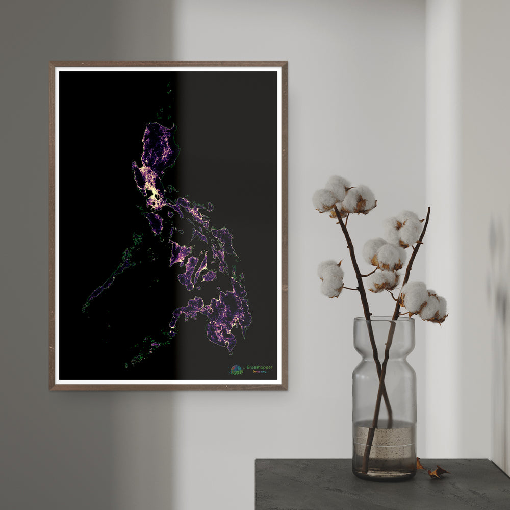
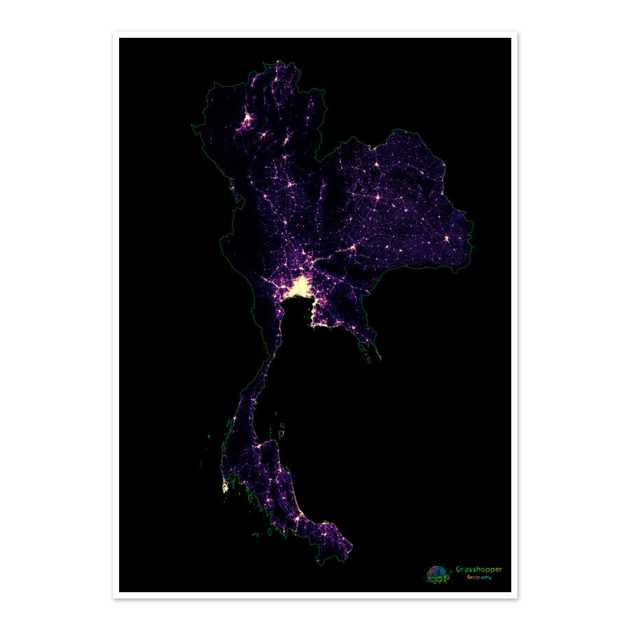
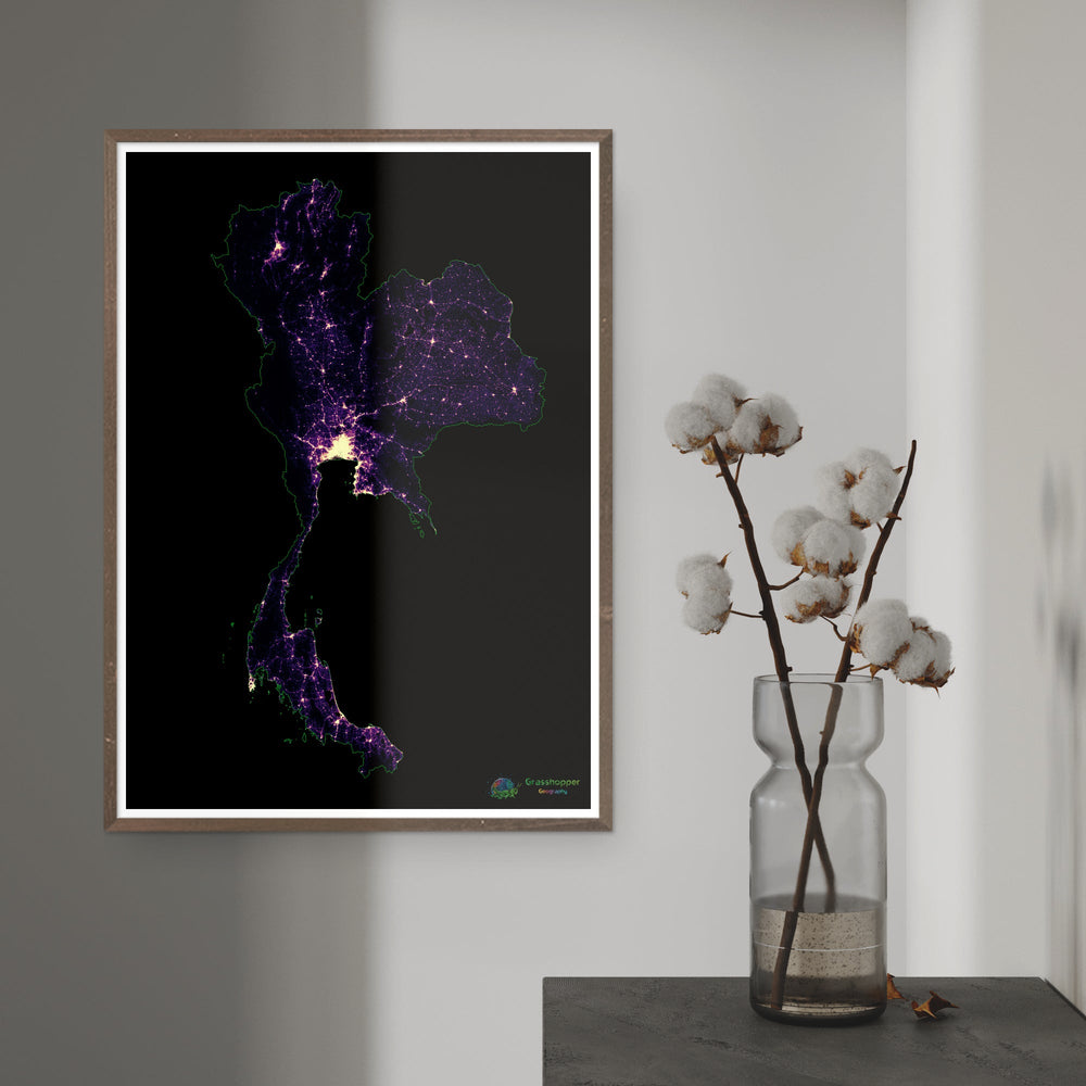
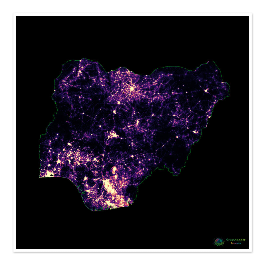
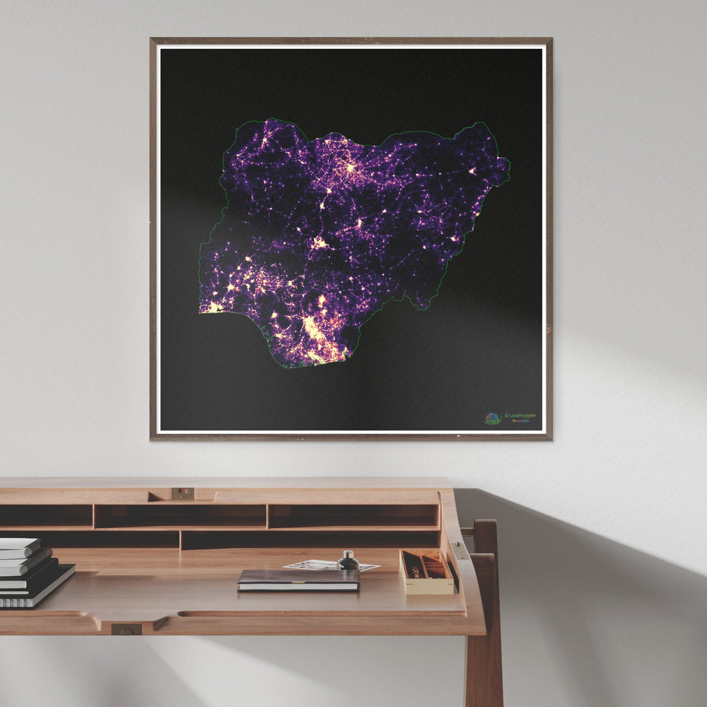
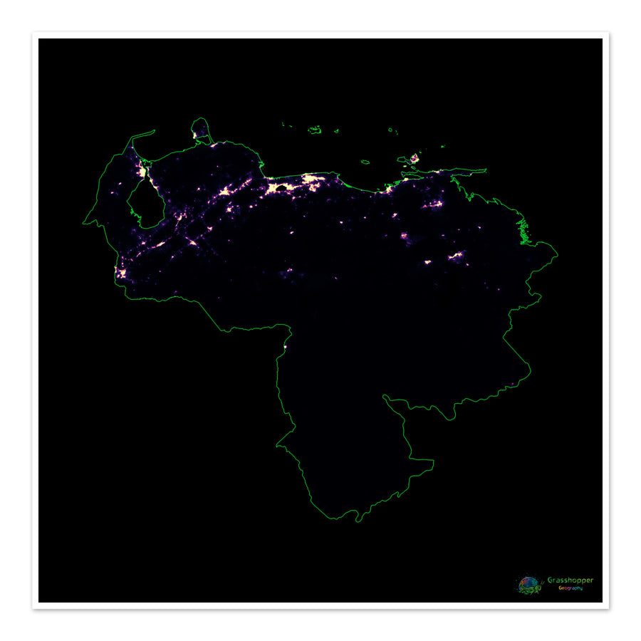
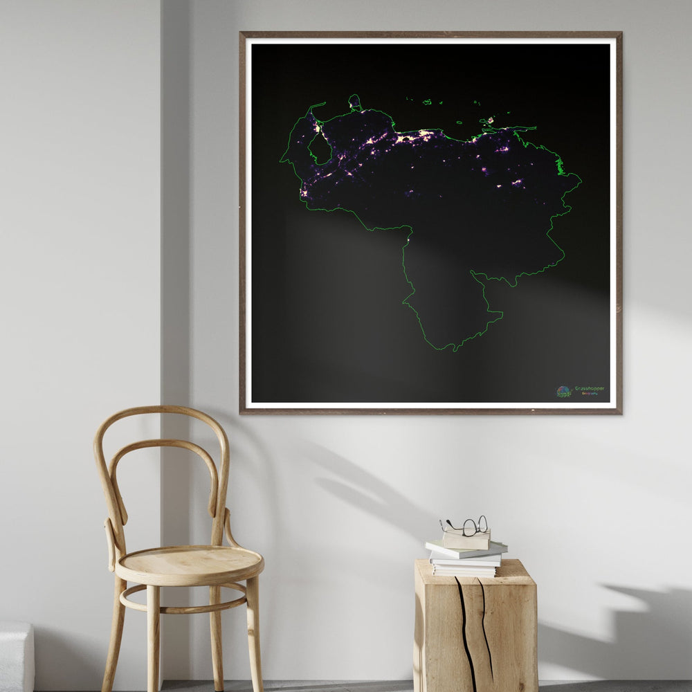
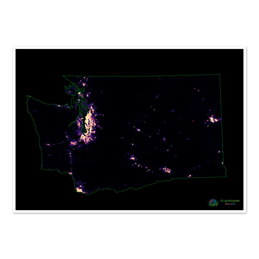
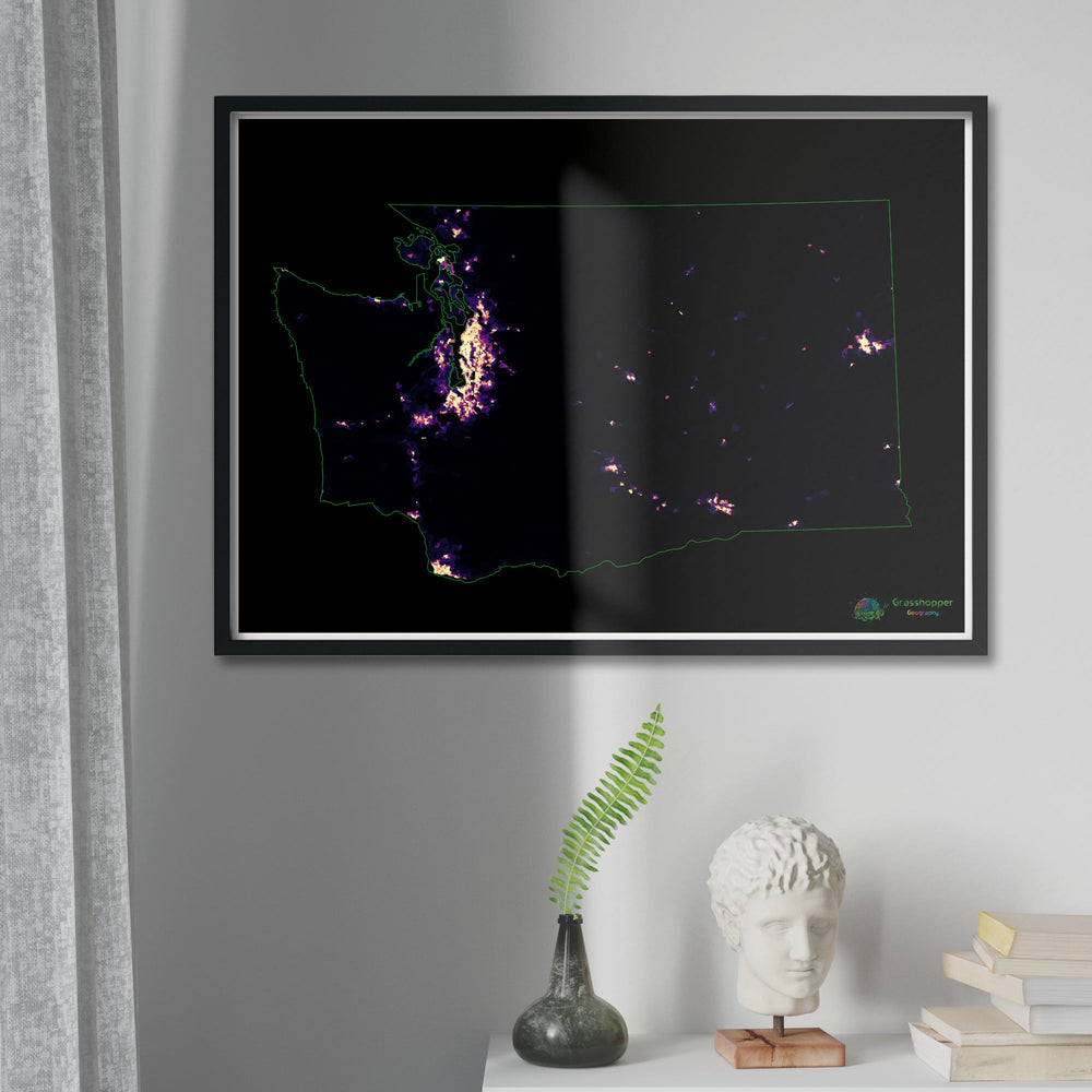
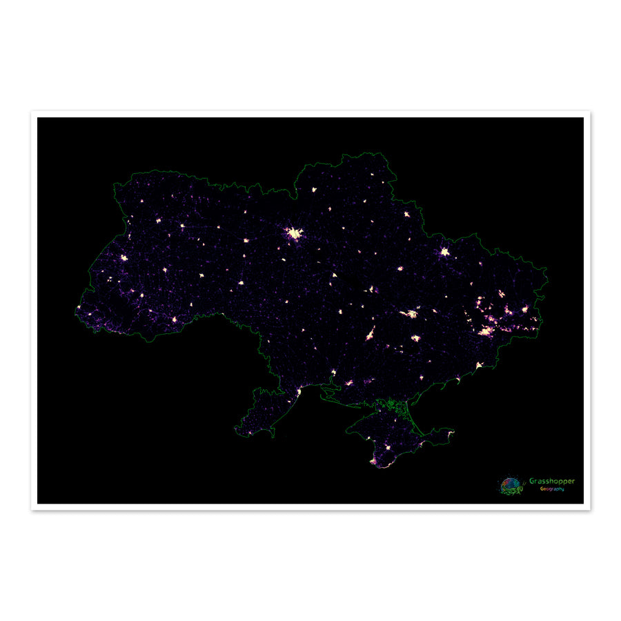
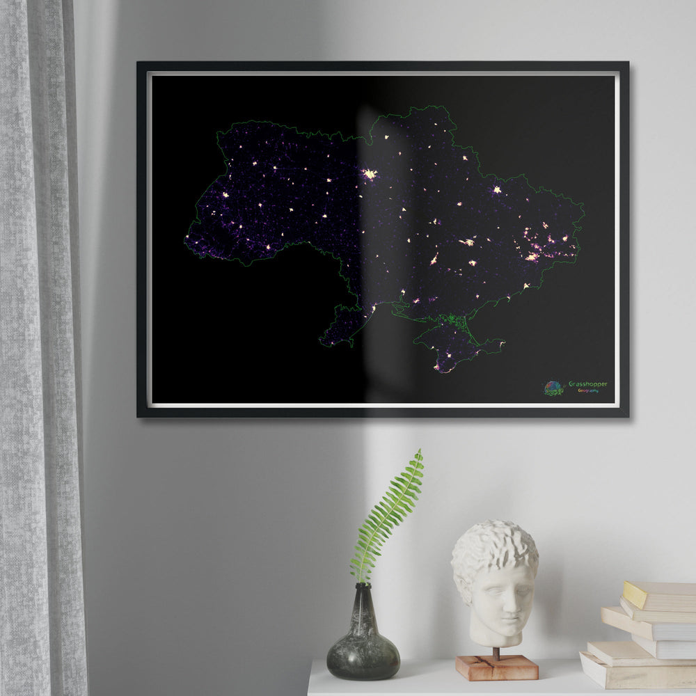
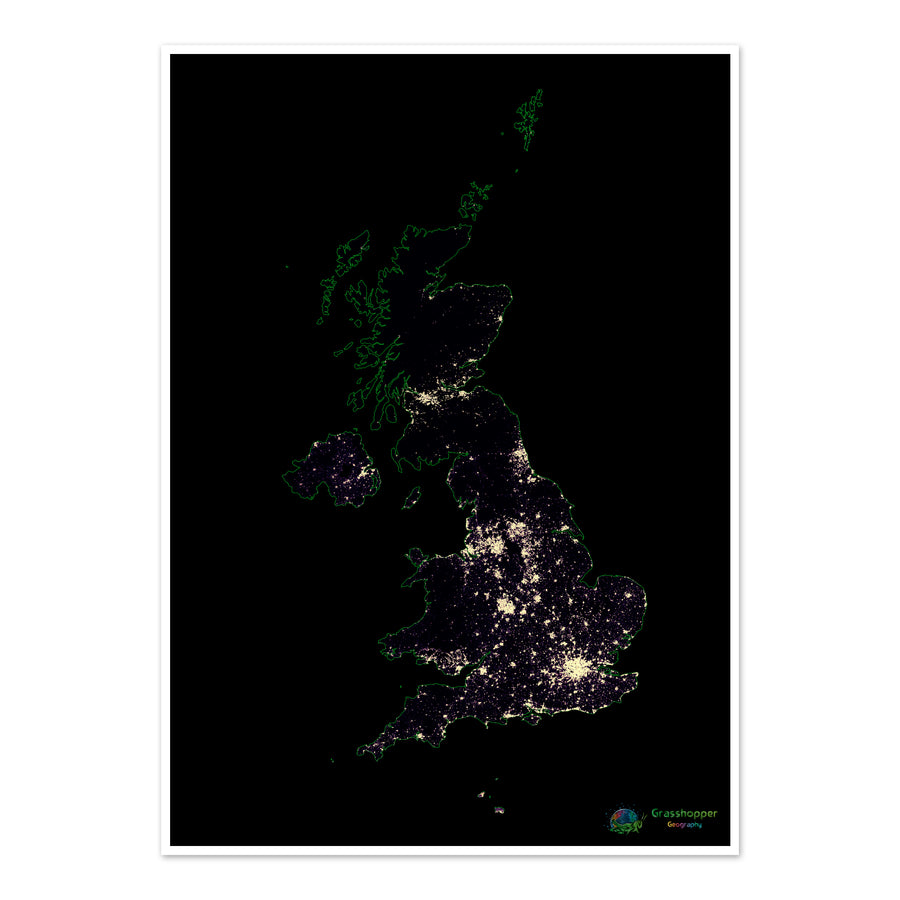
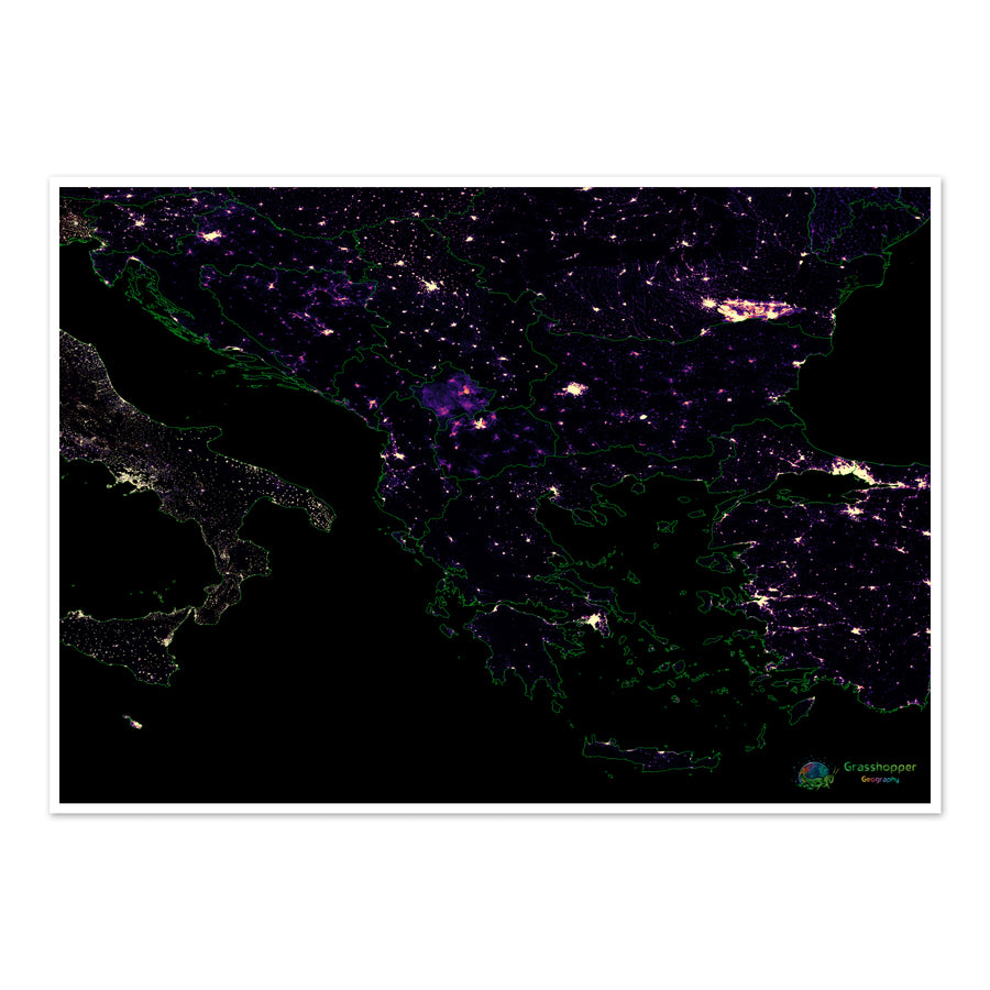
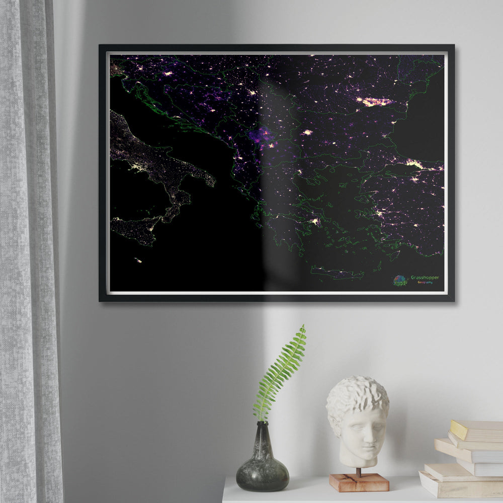
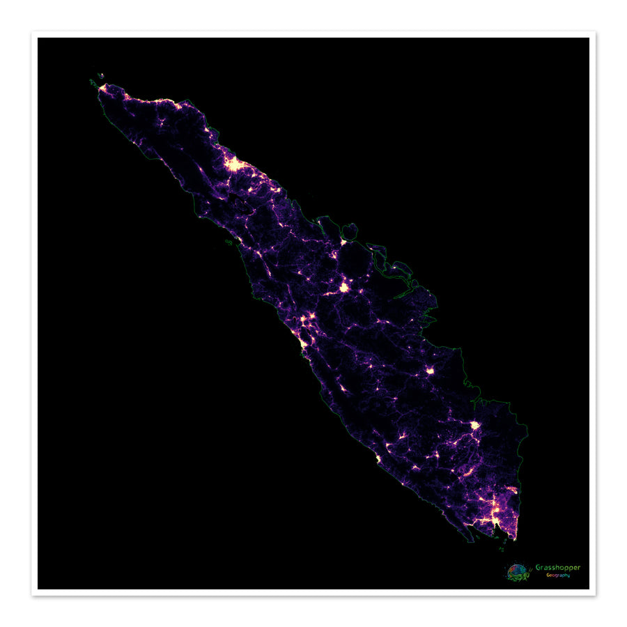
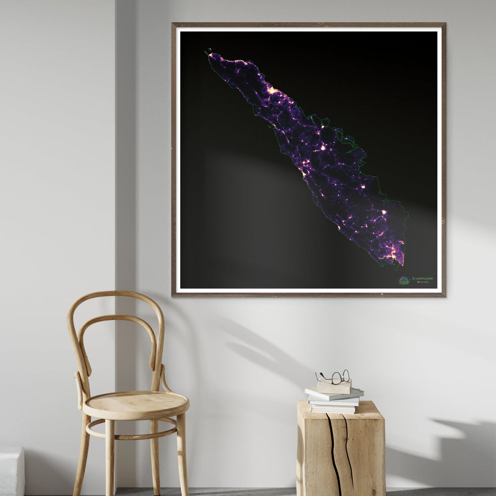
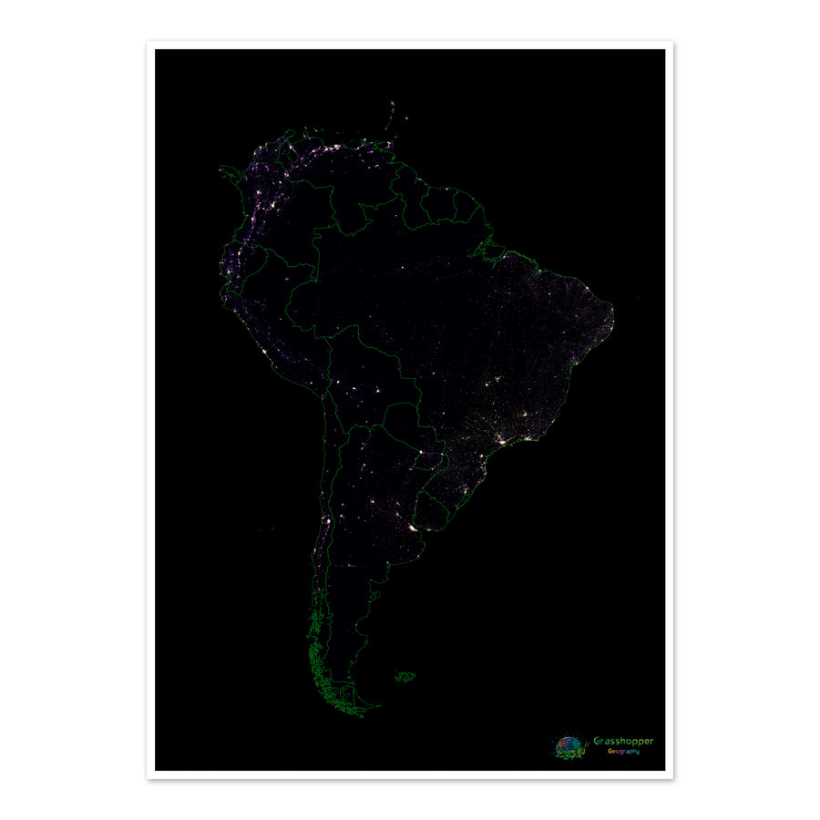
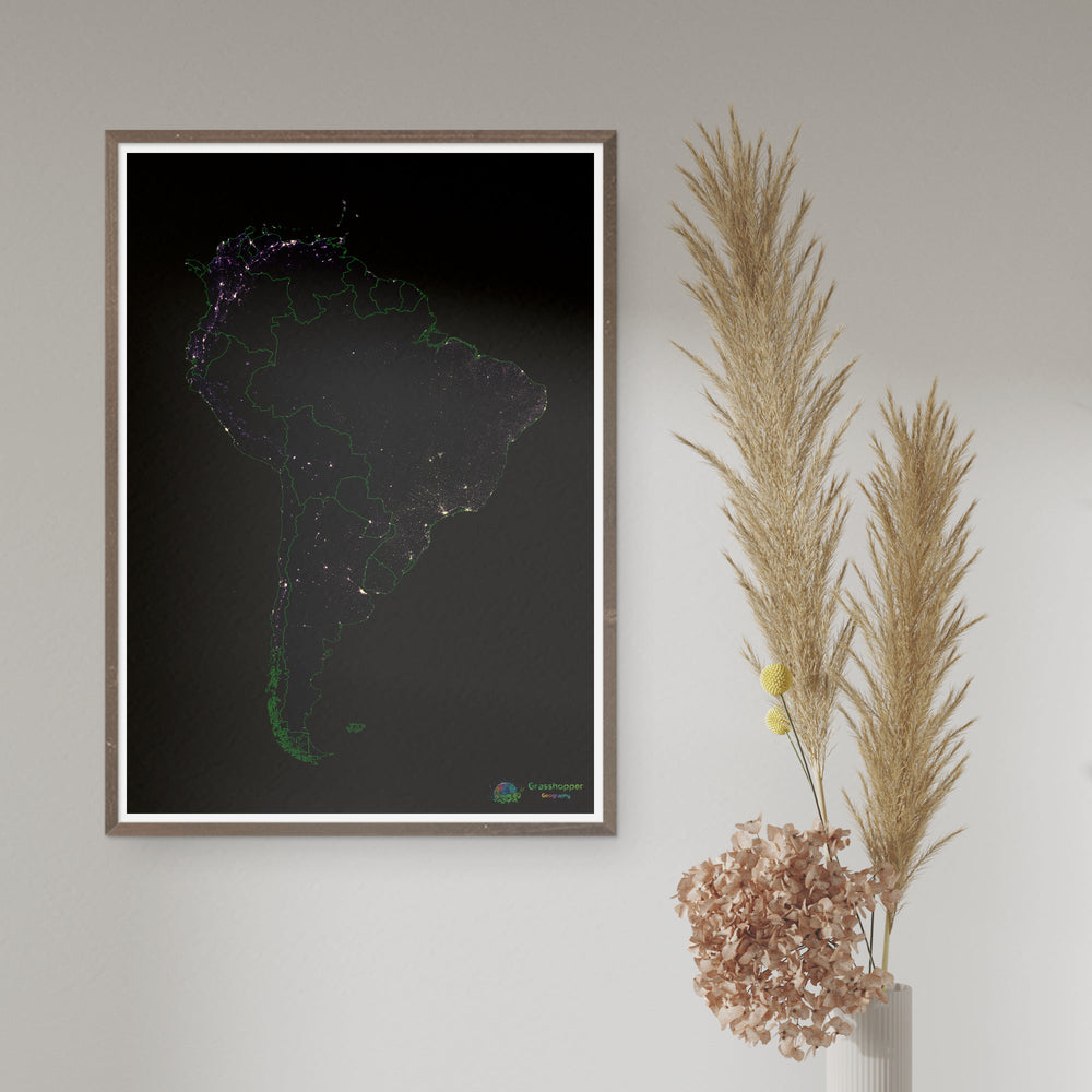
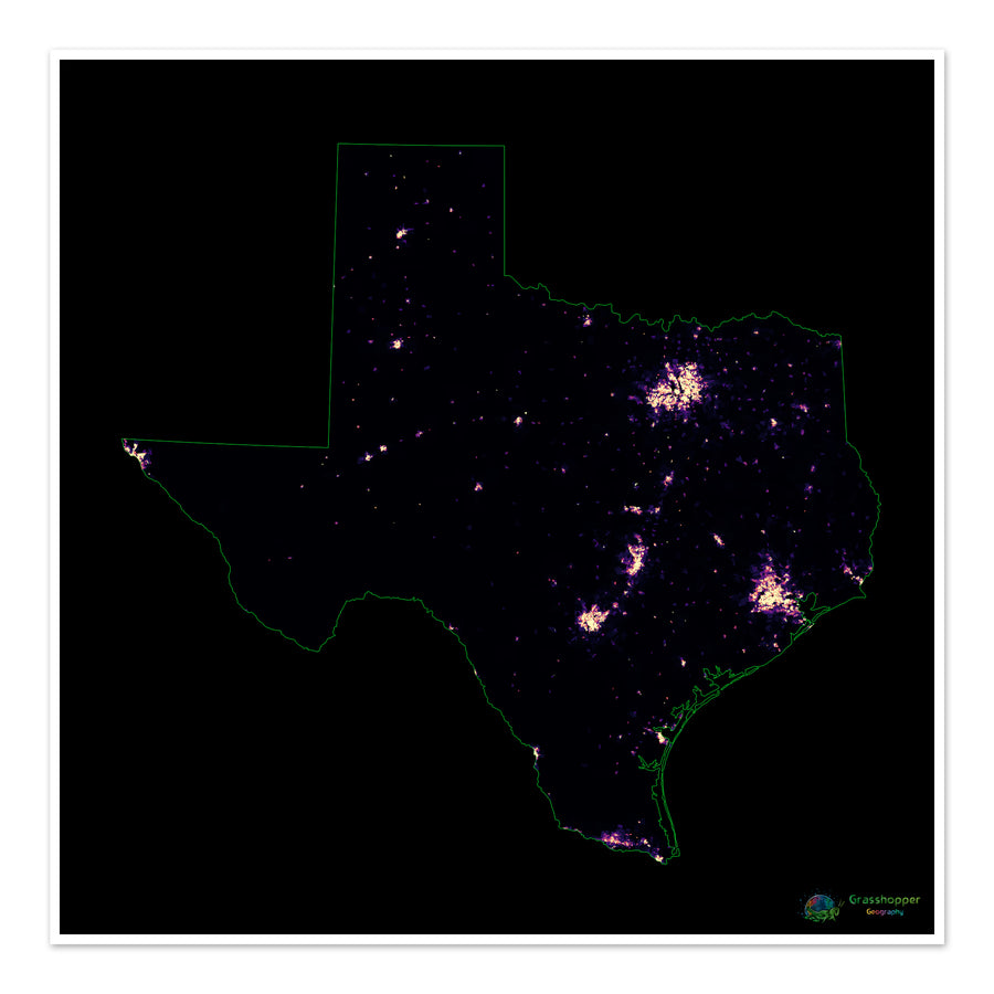
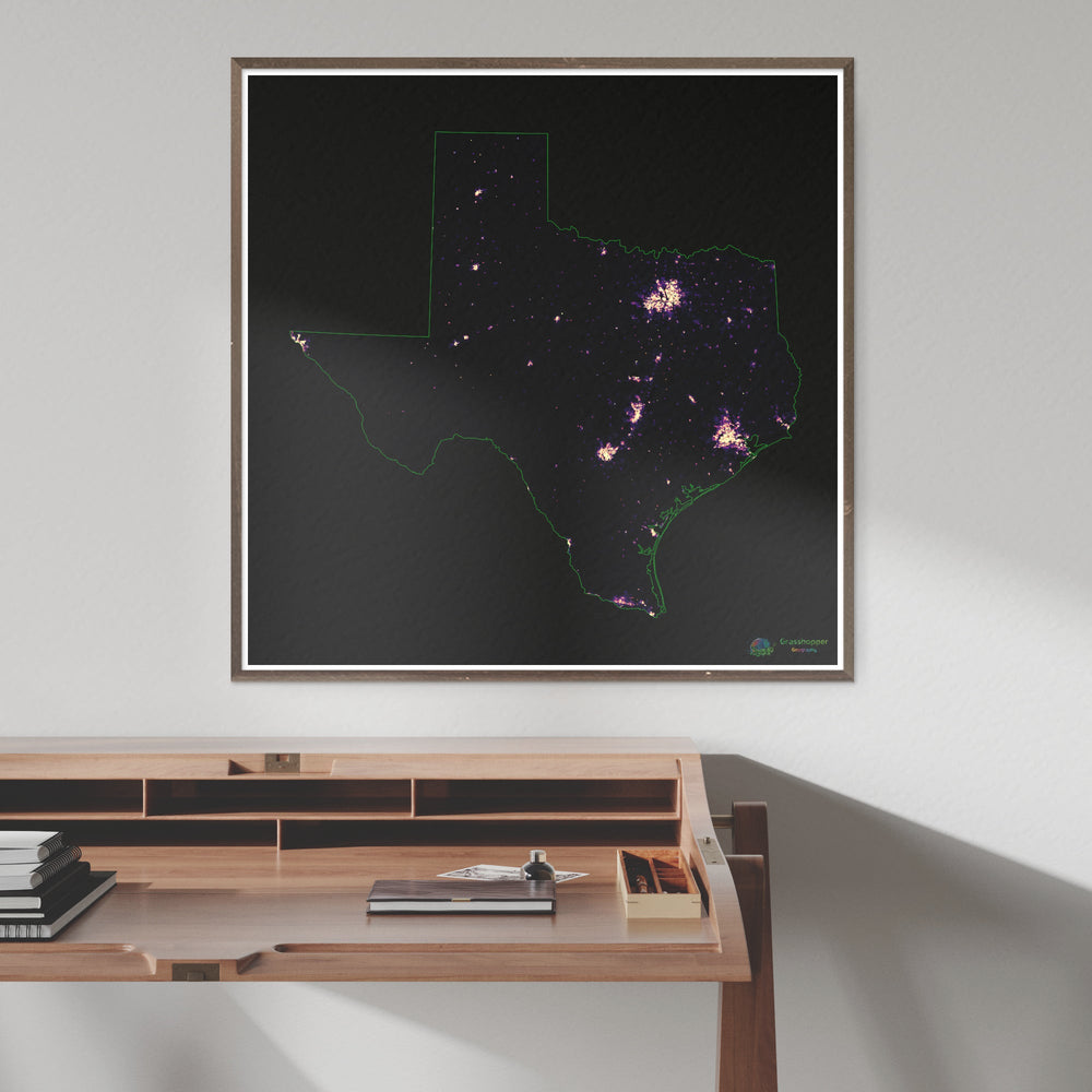
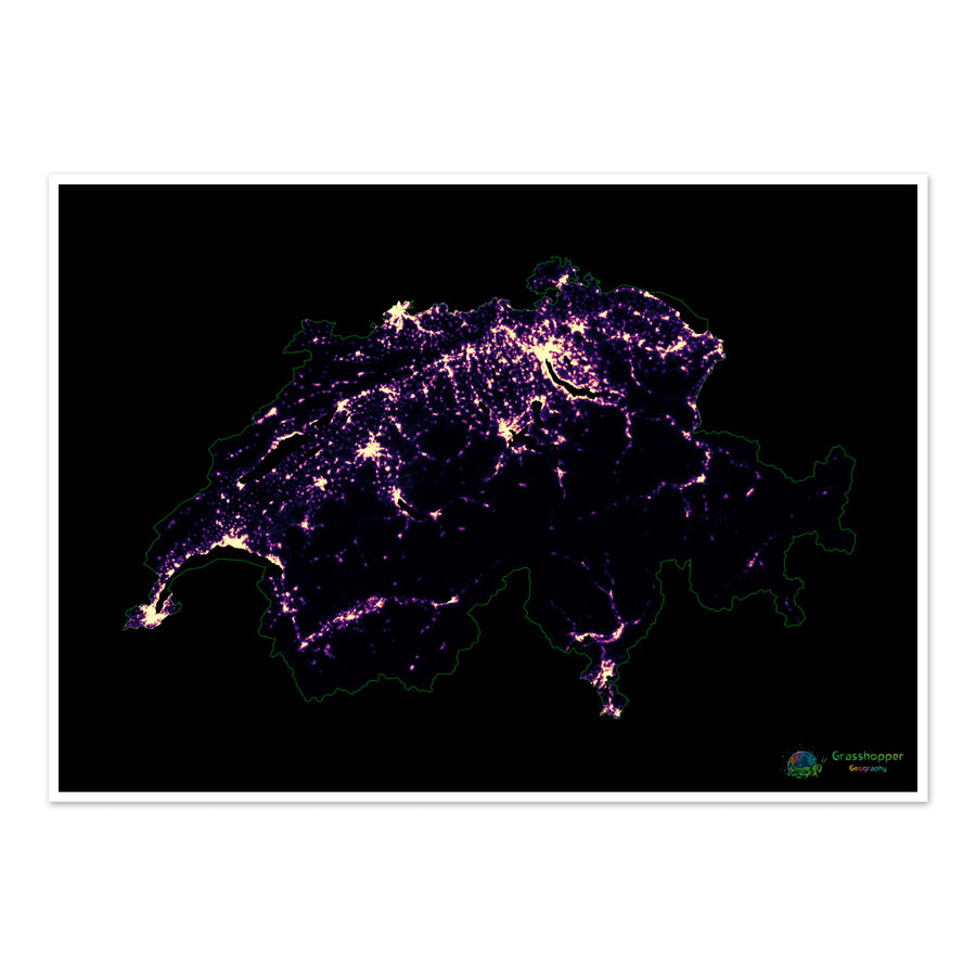
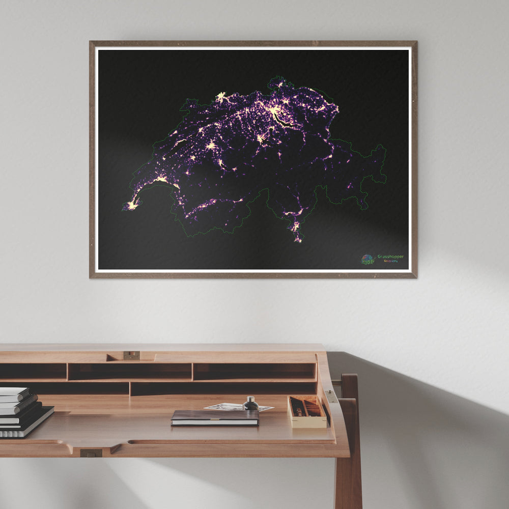
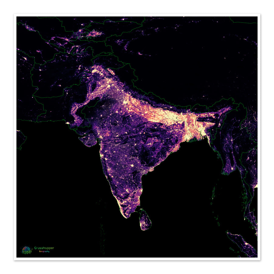
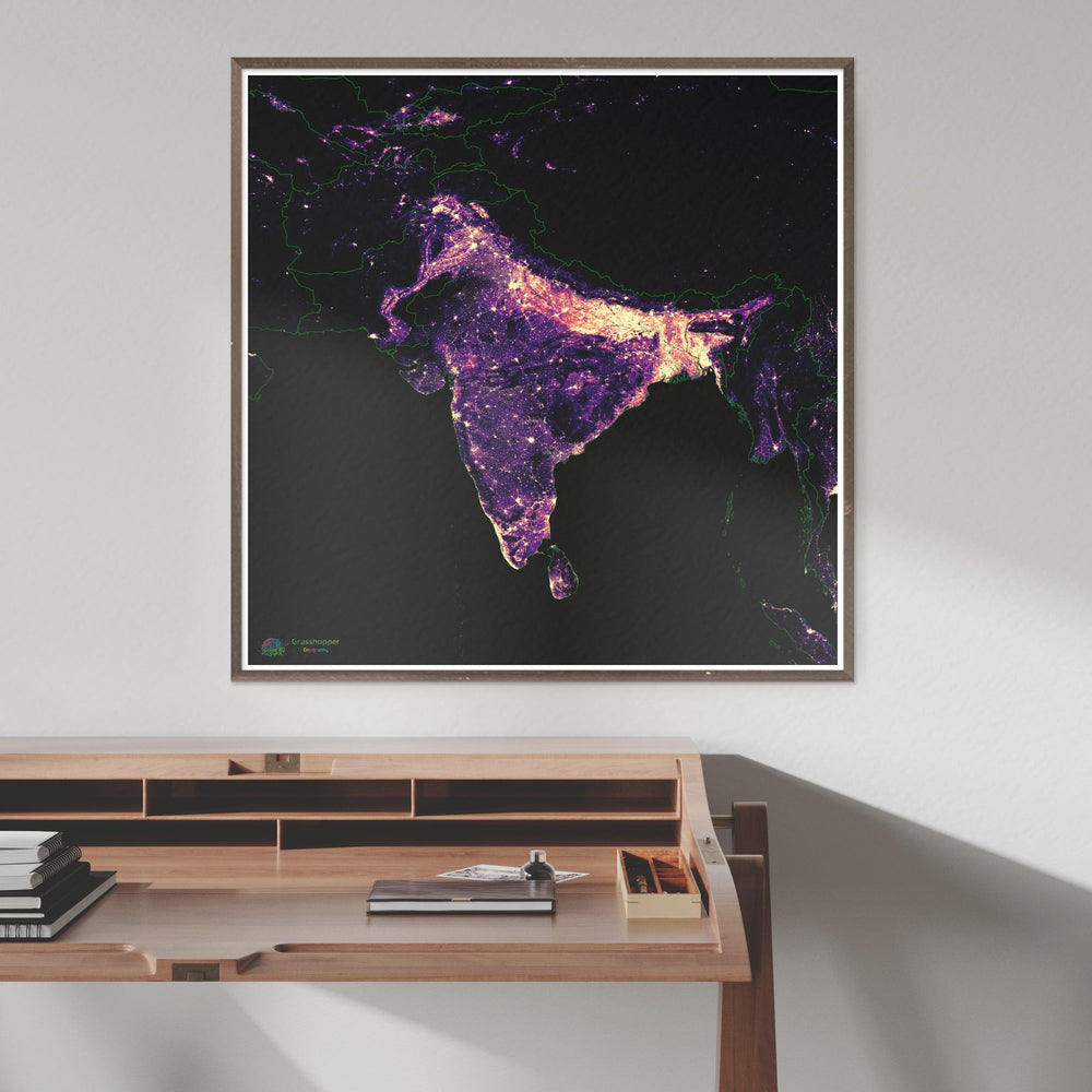
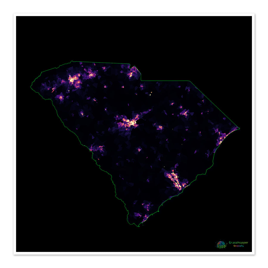
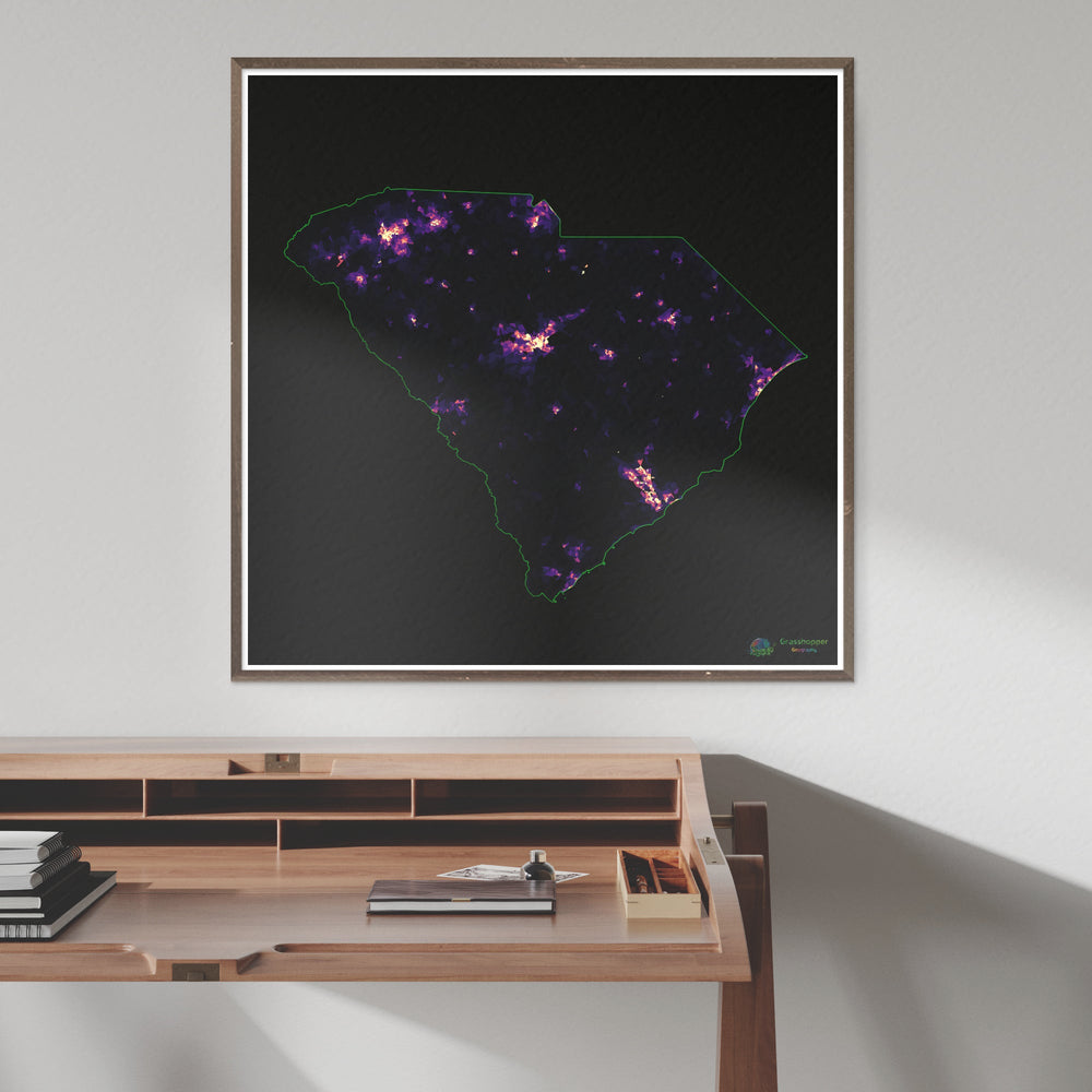
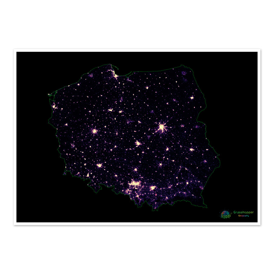
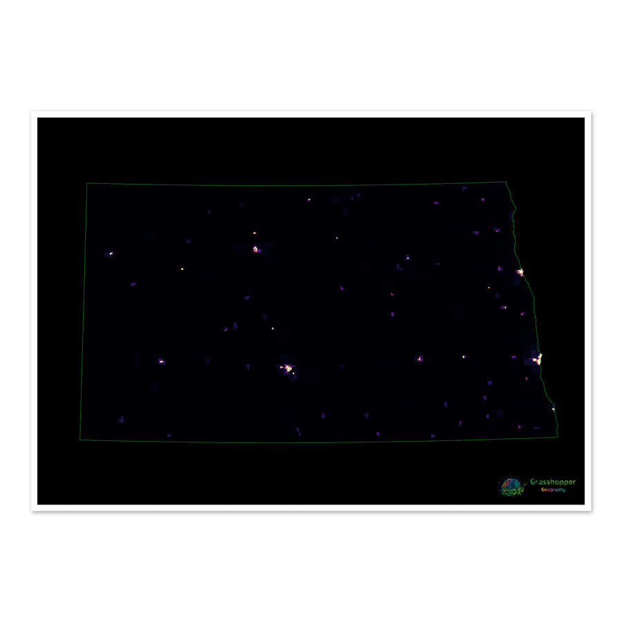
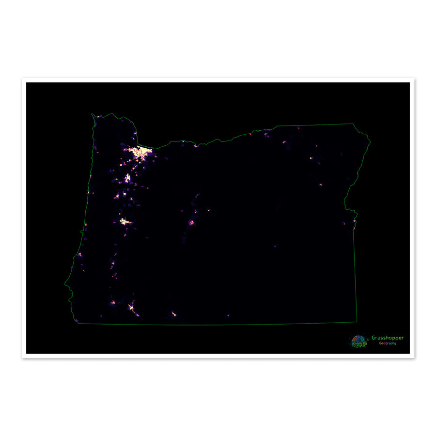
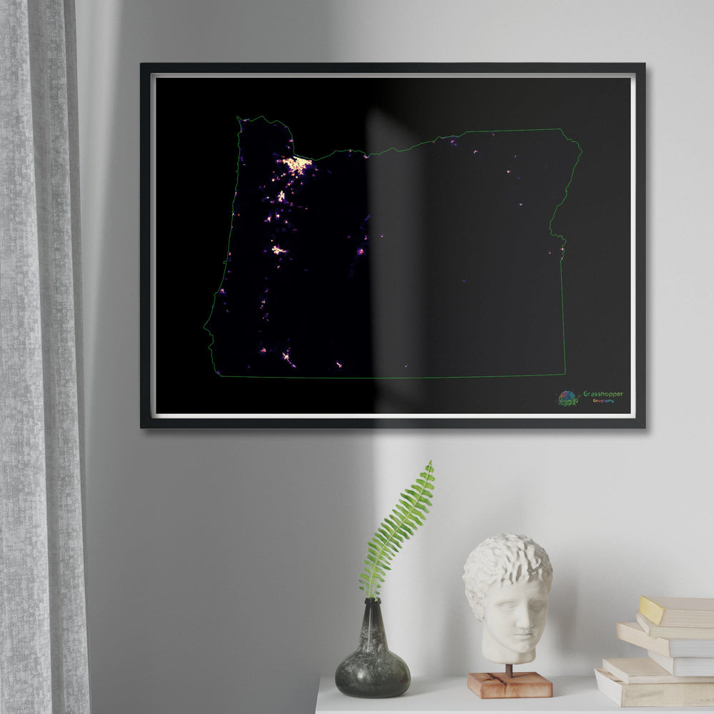
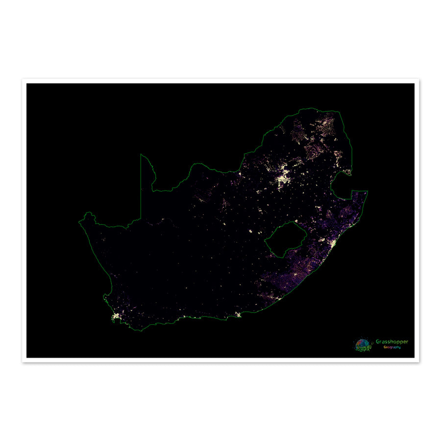
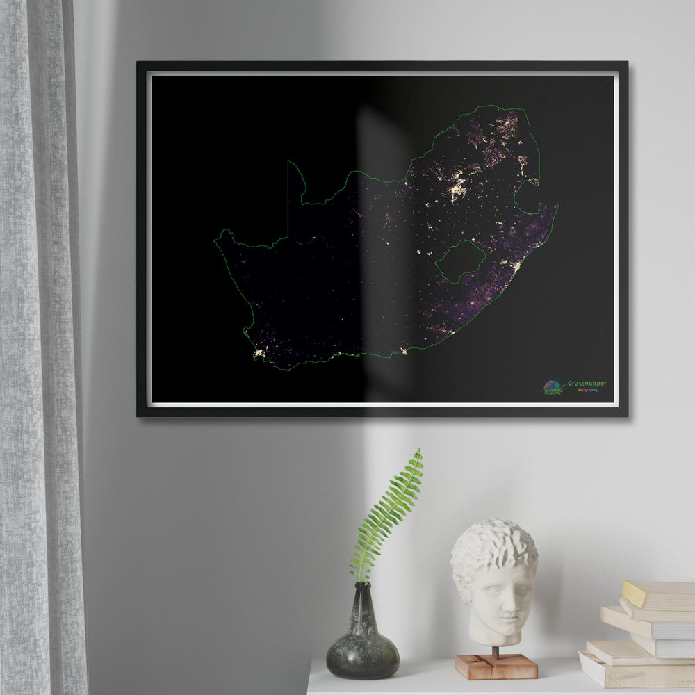
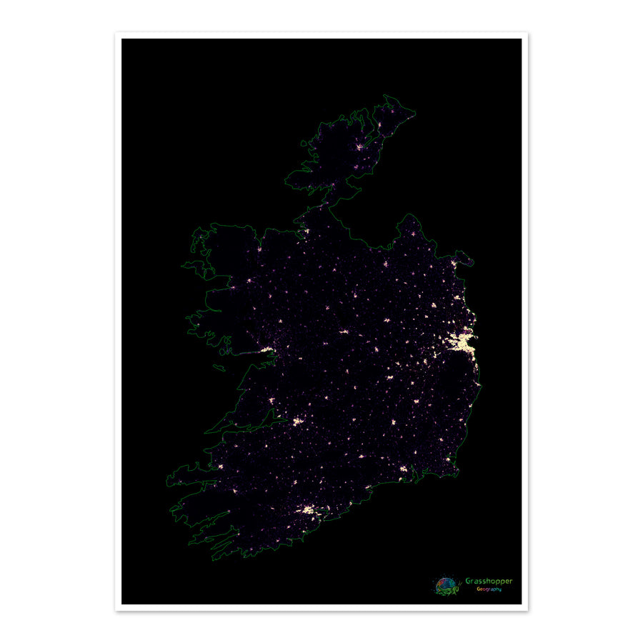
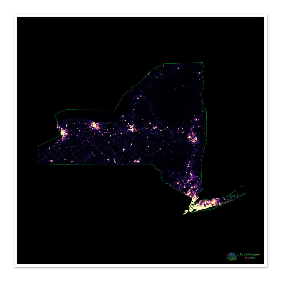
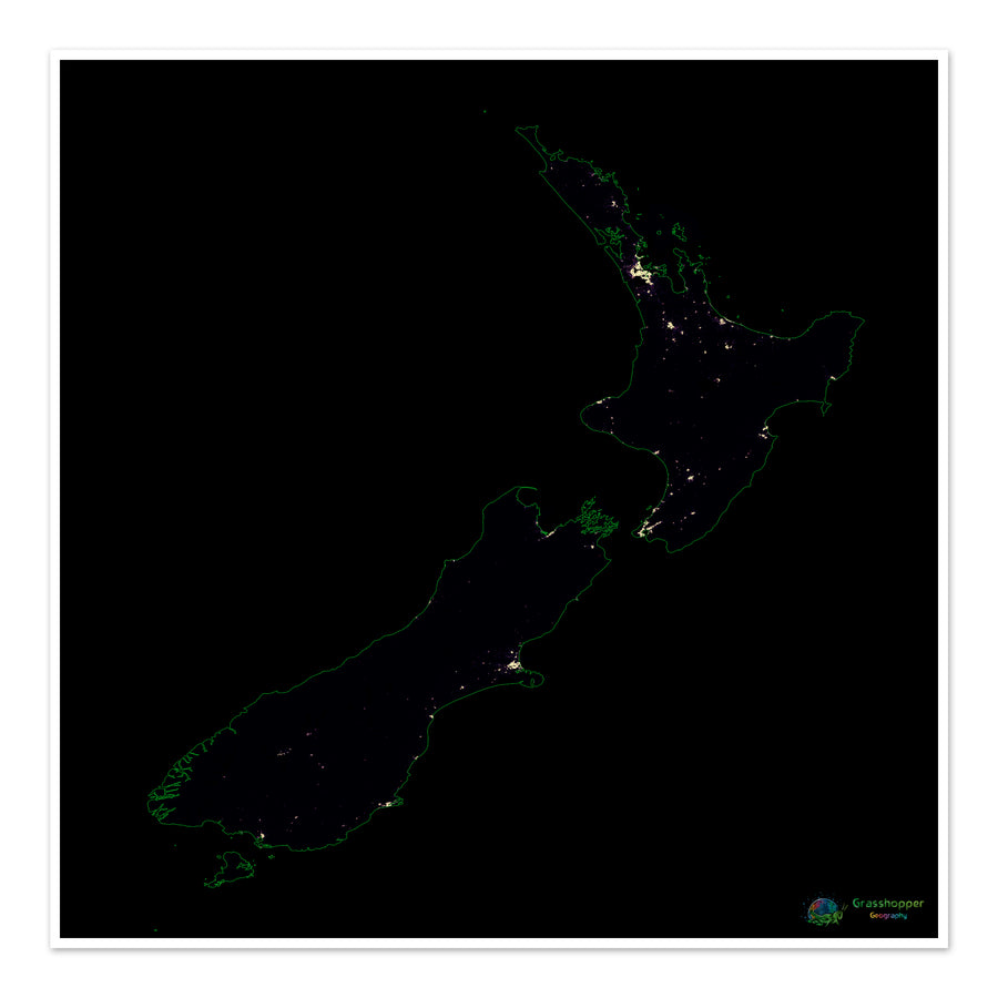
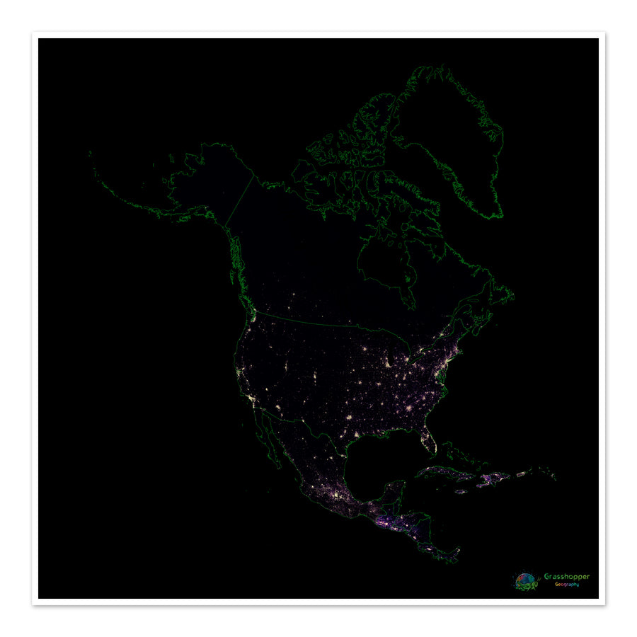
High resolution population density maps based on detailed global datasets, made to resemble star constellations and nebulae. The darker colours represent really low density areas, the yellows are dense urban centres and the purples in between.
.
.
.
.
Filter
61 products
Sort
Sort
Featured
Most relevant
Best selling
Alphabetically, A-Z
Alphabetically, Z-A
Price, low to high
Price, high to low
Date, old to new
Date, new to old
Large
Small
List
Quick shop
Add to cart
The world - Population density heatmap - Fine Art Print
1 review
from
$16
80
from
$16.80
"Close (esc)"
Quick shop
Add to cart
The United States - Population density heatmap - Fine Art Print
from
$16
80
from
$16.80
"Close (esc)"
Quick shop
Add to cart
The British Isles - Population density heatmap - Fine Art Print
from
$16
80
from
$16.80
"Close (esc)"
Quick shop
Add to cart
India - Population density heatmap - Fine Art Print
from
$15
60
from
$15.60
"Close (esc)"
Quick shop
Add to cart
France - Population density heatmap - Fine Art Print
from
$15
60
from
$15.60
"Close (esc)"
Quick shop
Add to cart
Europe - Population density heatmap - Fine Art Print
from
$15
60
from
$15.60
"Close (esc)"
Quick shop
Add to cart
Custom river basin and population density map of the world Fine Art Print
$96
00
$96.00
"Close (esc)"
Quick shop
Add to cart
Africa - Population density heatmap - Fine Art Print
from
$15
60
from
$15.60
"Close (esc)"
Quick shop
Add to cart
Italy - Population density heatmap - Fine Art Print
from
$15
60
from
$15.60
"Close (esc)"
Quick shop
Add to cart
CUSTOM Global Population Density Robinson Projection Fine Art Print
No reviews
$75
00
$75.00
"Close (esc)"
Quick shop
Add to cart
The Greater Mekong Subregion - Population density heatmap - Fine Art Print
from
$16
80
from
$16.80
"Close (esc)"
Quick shop
Add to cart
Taiwan - Population density heatmap - Fine Art Print
from
$16
80
from
$16.80
"Close (esc)"
Quick shop
Add to cart
Bulgaria - Population density heatmap - Fine Art Print
from
$16
80
from
$16.80
"Close (esc)"
Quick shop
Add to cart
Australia - Population density heatmap - Fine Art Print
from
$16
80
from
$16.80
"Close (esc)"
Quick shop
Add to cart
The Netherlands - Population density heatmap - Fine Art Print
from
$16
80
from
$16.80
"Close (esc)"
Quick shop
Add to cart
The island of Ireland - Population density heatmap - Fine Art Print
from
$16
80
from
$16.80
"Close (esc)"
Quick shop
Add to cart
Spain - Population density heatmap - Fine Art Print
from
$16
80
from
$16.80
"Close (esc)"
Quick shop
Add to cart
Russia - Population density heatmap - Fine Art Print
from
$16
80
from
$16.80
"Close (esc)"
Quick shop
Add to cart
Mexico - Population density heatmap - Fine Art Print
from
$16
80
from
$16.80
"Close (esc)"
Quick shop
Add to cart
The Horn of Africa - Population density heatmap - Fine Art Print
from
$15
60
from
$15.60
"Close (esc)"
Quick shop
Add to cart
The Philippines - Population density heatmap - Fine Art Print
from
$16
80
from
$16.80
"Close (esc)"
Quick shop
Add to cart
Thailand - Population density heatmap - Fine Art Print
from
$16
80
from
$16.80
"Close (esc)"
Quick shop
Add to cart
Nigeria - Population density heatmap - Fine Art Print
from
$15
60
from
$15.60
"Close (esc)"
Quick shop
Add to cart
Venezuela - Population density heatmap - Fine Art Print
from
$15
60
from
$15.60
"Close (esc)"
Quick shop
Add to cart
Washington - Population density heatmap - Fine Art Print
from
$16
80
from
$16.80
"Close (esc)"
Quick shop
Add to cart
Ukraine - Population density heatmap - Fine Art Print
from
$16
80
from
$16.80
"Close (esc)"
Quick shop
Add to cart
The United Kingdom - Population density heatmap - Fine Art Print
from
$16
80
from
$16.80
"Close (esc)"
Quick shop
Add to cart
The Balkans - Population density heatmap - Fine Art Print
from
$16
80
from
$16.80
"Close (esc)"
Quick shop
Add to cart
Sumatra - Population density heatmap - Fine Art Print
from
$15
60
from
$15.60
"Close (esc)"
Quick shop
Add to cart
South America - Population density heatmap - Fine Art Print
from
$16
80
from
$16.80
"Close (esc)"
Quick shop
Add to cart
Texas - Population density heatmap - Fine Art Print
from
$15
60
from
$15.60
"Close (esc)"
Quick shop
Add to cart
Switzerland - Population density heatmap - Fine Art Print
from
$16
80
from
$16.80
"Close (esc)"
Quick shop
Add to cart
South Asia - Population density heatmap - Fine Art Print
from
$15
60
from
$15.60
"Close (esc)"
Quick shop
Add to cart
South Carolina - Population density heatmap - Fine Art Print
from
$15
60
from
$15.60
"Close (esc)"
Quick shop
Add to cart
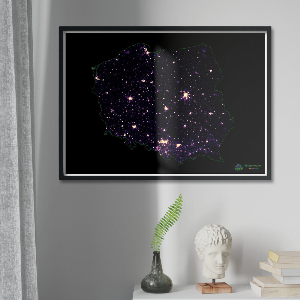
Poland - Population density heatmap - Fine Art Print
from
$16
80
from
$16.80
"Close (esc)"
Quick shop
Add to cart
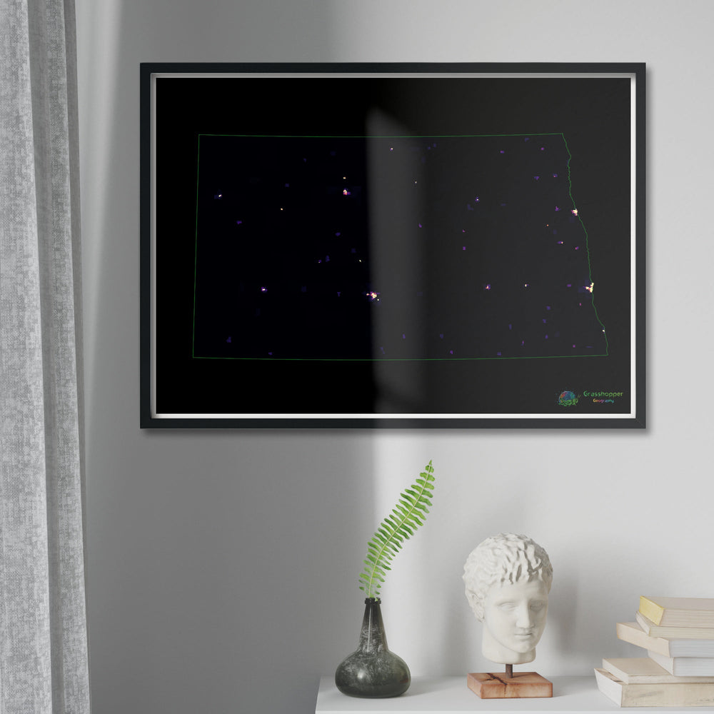
North Dakota - Population density heatmap - Fine Art Print
from
$16
80
from
$16.80
"Close (esc)"
Quick shop
Add to cart
Oregon - Population density heatmap - Fine Art Print
from
$16
80
from
$16.80
"Close (esc)"
Quick shop
Add to cart
South Africa - Population density heatmap - Fine Art Print
from
$16
80
from
$16.80
"Close (esc)"
Quick shop
Add to cart
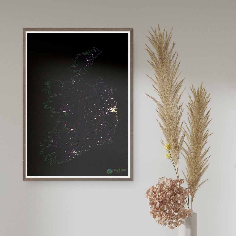
Ireland - Population density heatmap - Fine Art Print
from
$16
80
from
$16.80
"Close (esc)"
Quick shop
Add to cart
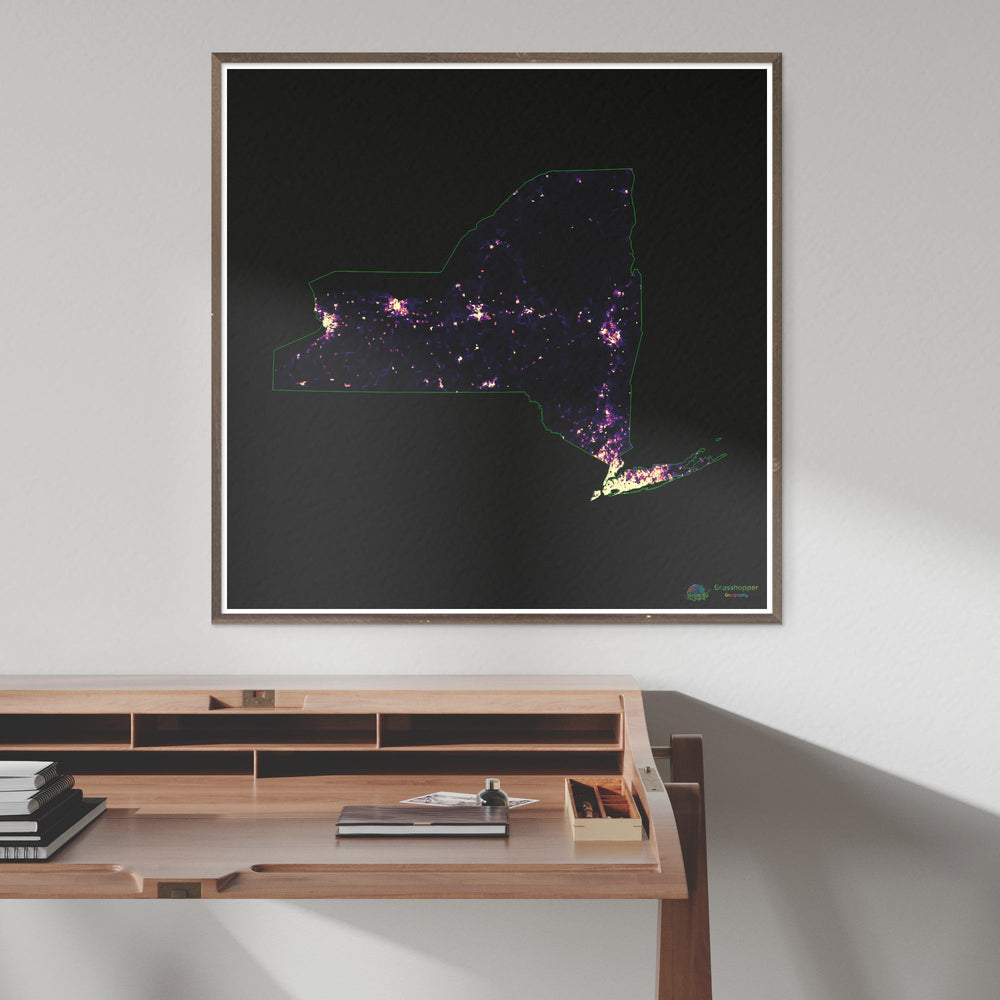
New York - Population density heatmap - Fine Art Print
from
$15
60
from
$15.60
"Close (esc)"
Quick shop
Add to cart
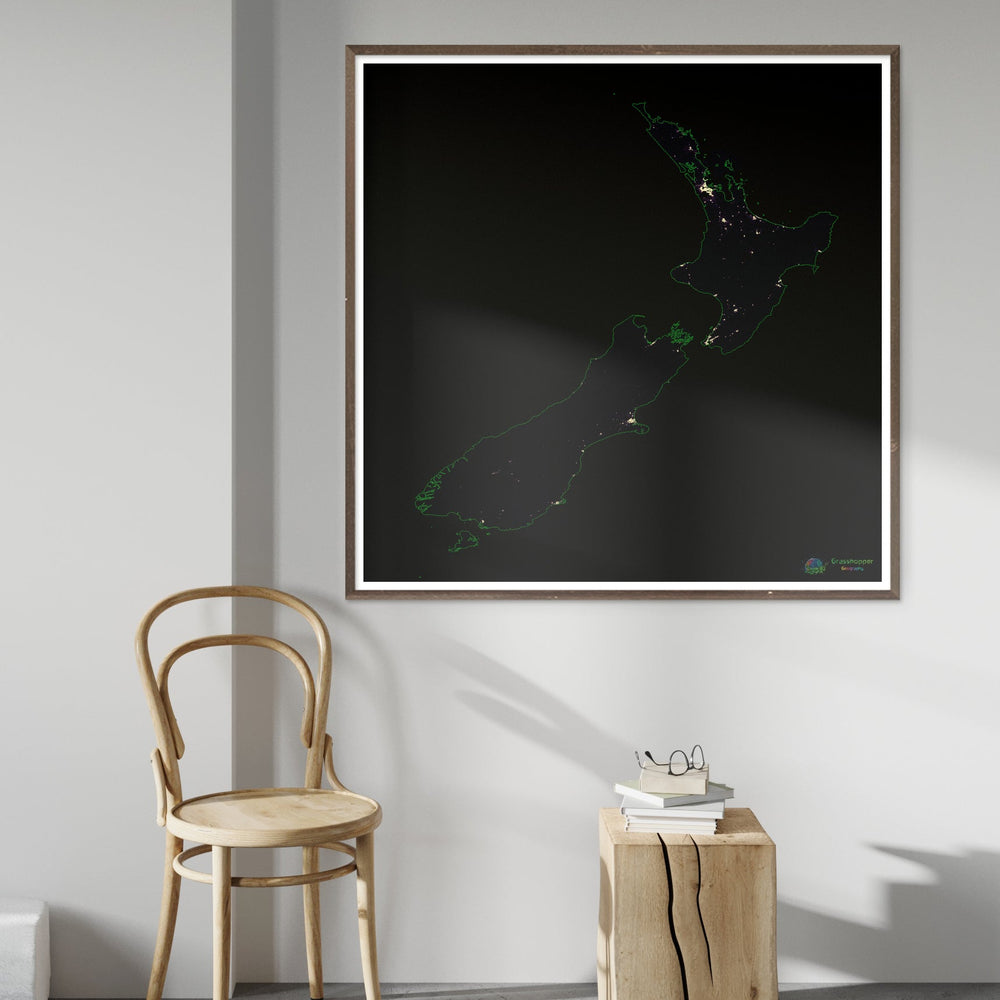
New Zealand - Population density heatmap - Fine Art Print
from
$15
60
from
$15.60
"Close (esc)"
Quick shop
Add to cart
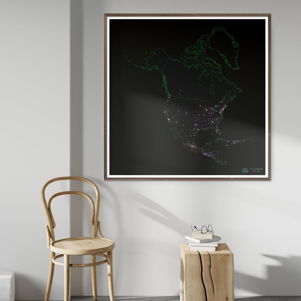
North America - Population density heatmap - Fine Art Print
from
$15
60
from
$15.60
"Close (esc)"
1
2
icon-chevron
Next
Recently viewed
"Close (esc)"
icon-chevron
"Close (esc)"
Population maps by Grasshopper Geography