Collaborations
A selection of our collaborations with environmental organizations, educators, writers, movie makers and other amazing, passionate people.
OUR LATEST AND GREATEST
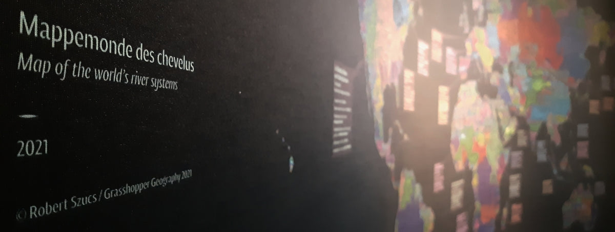
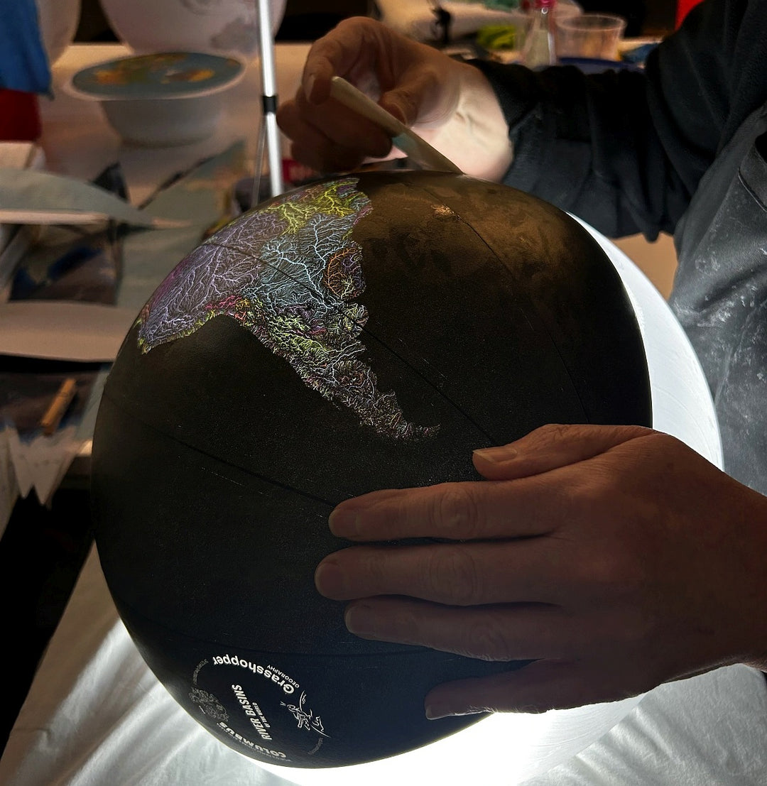
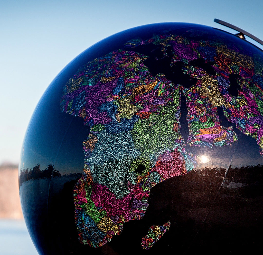
Collaboration with columbus globes
Our famous, colourful maps are now available on handcrafted premium globes as a result of an exciting collaboration with Columbus, the oldest globe manufacturer in the world.
The Columbus brand is the absolute top of the line in the globe industry. Their globes strike a remarkable balance between traditional artisan manufacturing and innovative engineering.
With a history of excellence that spans five generations, Columbus globes have been handcrafted with precision for over a century in Germany.
NGO Collaborations
We'd like to say a huge thanks to all non-governmental organizations for reaching out, asking about the use of our work. The fact that they find our maps fitting to illustrate the important causes they fight for really means a lot to us.
These non-profit organizations usually do their work on a limited (or sometimes non-existent) budget, so we are more than happy to let go of the licensing fee to help their cause. We really hope our work can help raise awareness and deliver their messages all around the world.
If you are working on a similar project or would like to use our maps for educational purposes, please feel free to contact us so we can discuss the details.
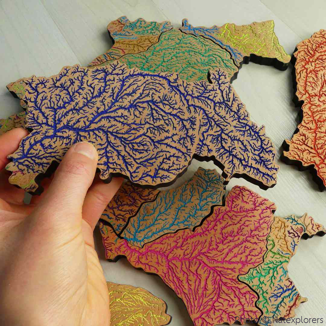
NatExplorers
NatExplorers used our river basin map of France and a custom Loire basin map to aid their project Loire Sentinelle in 2022. They also developed pedagogical tools to help educate the public about the overall health of the Loire river and its biodiversity. A couple of educational puzzles were created from our river basin map of France.
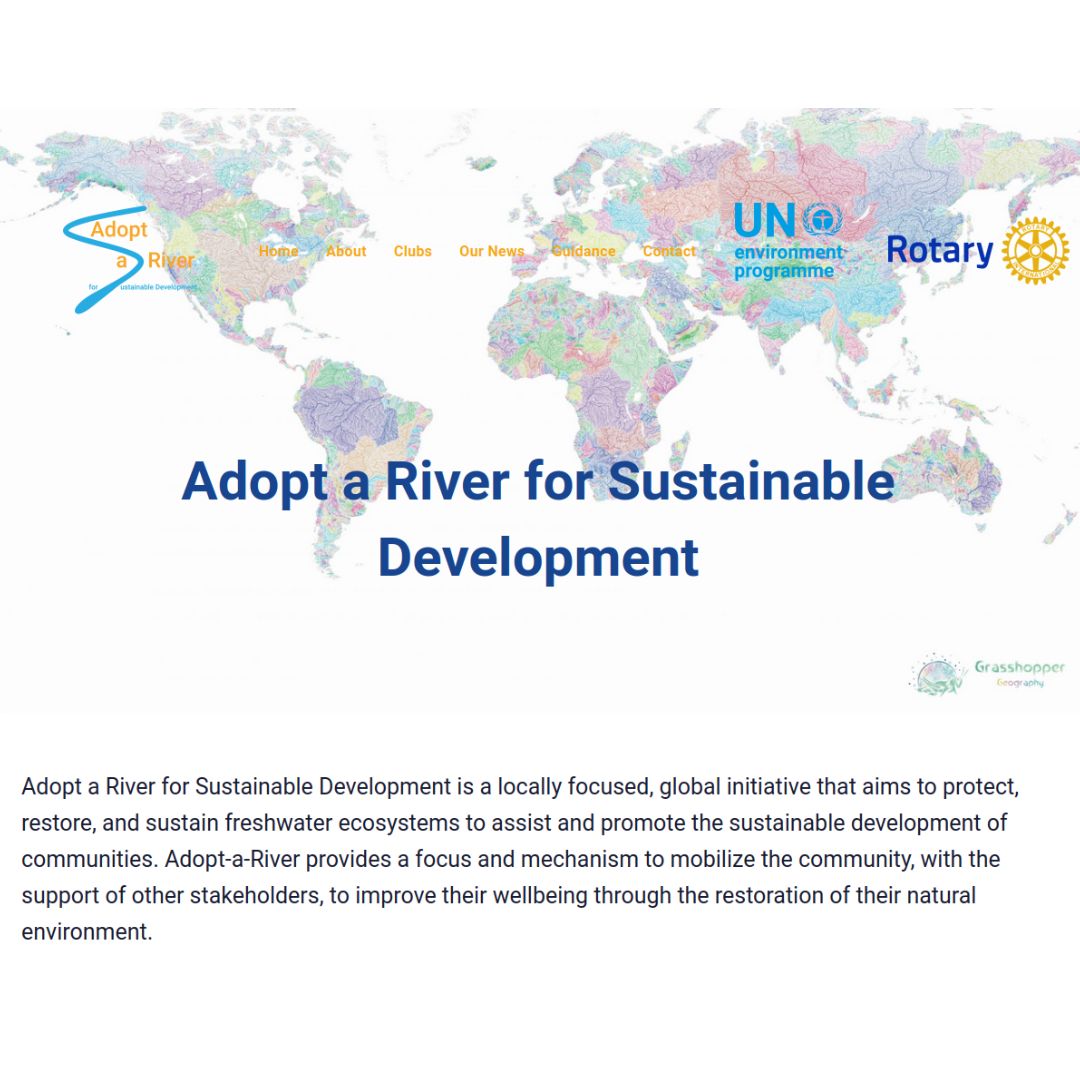
UNEP Adopt a River initiative
Adopt-a-River for Sustainable Development is a global initiative, a partnership between the United Nations Environment Programme and Rotary International. It aims to protect and restore freshwater ecosystems and helps in the sustainable development of communities. Our river basin map of the world plays a key role in the campaign.
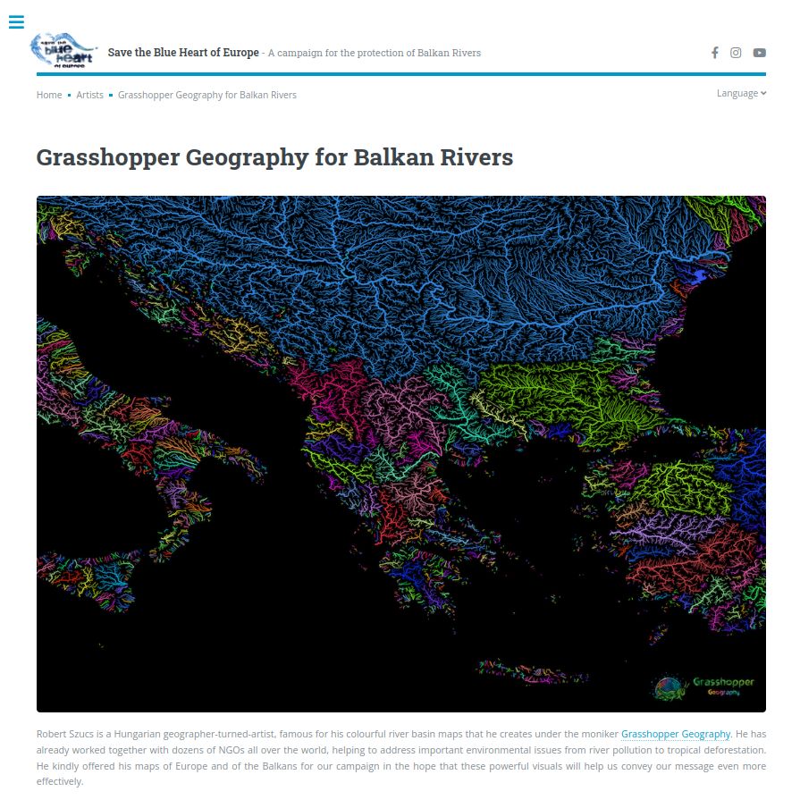
Save the Blue Heart of Europe
RiverWatch and EuroNatur use our river basin map of the Balkans and our custom-made Vjosa river map to illustrate the importance of free-flowing rivers in the Balkans in their international campaign Save the Blue Heart of Europe.
Heal the bay
Heal the Bay is a Los Angeles-based non-profit organization that not only organizes regular beach and neighbourhood cleanups, they also work to mobilize LA’s diverse communities to protect their coastline, restore waterways, and speak out for clean water policy across Californian watersheds. They used our California river basin map in their educational presentations and many times shared it on their social media channels.
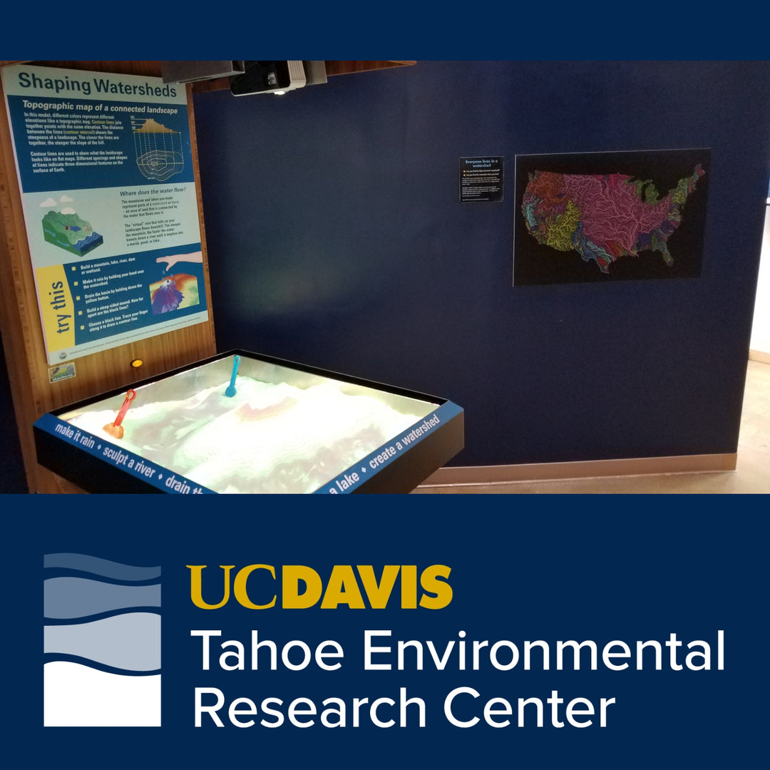
Tahoe science center
The UC Davis Tahoe Science Center's interactive exhibits let you learn about the lake ecosystem, why it's changing, and help find out how to keep Tahoe blue. Our river basin map of the contiguous United States hangs next to their augmented reality sandbox.
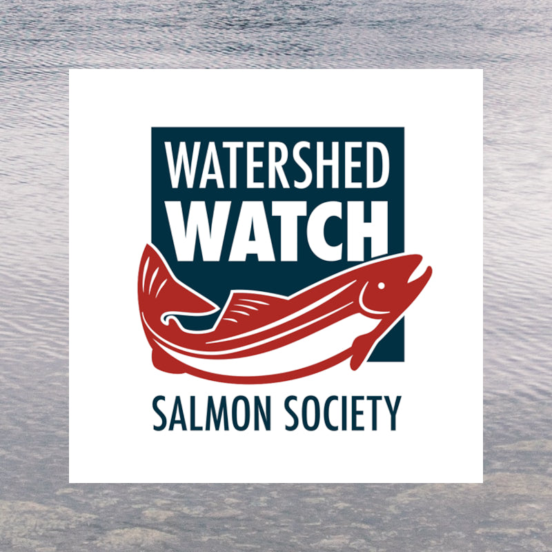
Watershed Watch Salmon Society
Watershed Watch Salmon Society works to defend and rebuild British Columbia's wild salmon and their habitats. They used our British Columbia river basin map in their short video on how climate change affects wild salmon in the area: Can salmon adapt to a changing climate?
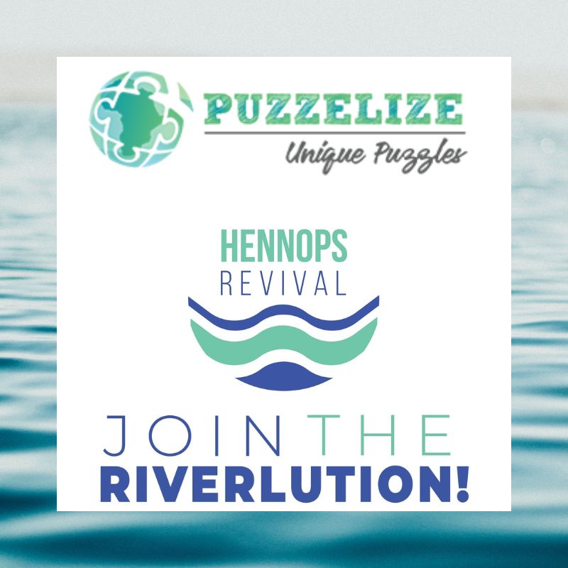
Puzzelize / Hennops Revival
Linda Liebenberg's puzzles are not only colourful and unique, but they are always designed and sold for a great cause. Her Riverlution puzzle depicts our river basin map of Africa and all of its proceeds go to Hennops Revival, a nonprofit company with the focus on restoring and healing the Hennops river in collaboration with the South African government and fellow NGOs.
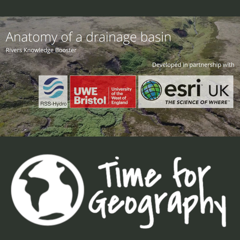
Time for geography
Time for Geography is an award-winning educational site that makes inspiring, open-access geography and geoscience videos for everyone to enjoy. They used our river basin map of the world for their knowledge-booster video on watersheds: Anatomy of a drainage basin
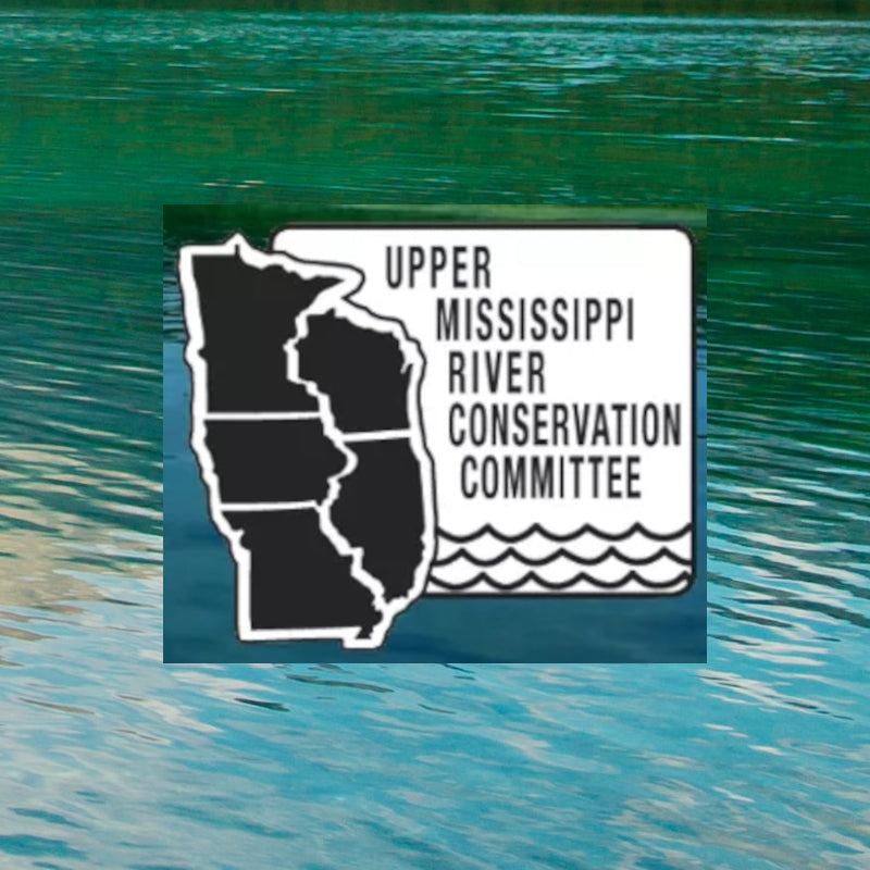
Upper Mississippi River Conservation Committee
The Upper Mississippi River Conservation Committee promotes preservation and wise utilization of natural and recreational resources of the Upper Mississippi River. A custom map of Illinois was donated to a raffle at their annual meeting in 2019. The money raised was used to help support research and other conservation projects in the watershed.
Trout Unlimited
Trout Unlimited is a non-profit organization with 300,000 members and supporters dedicated to conserving, protecting and restoring North America’s coldwater fisheries and their watersheds. A custom map of the Great Lakes watershed was created for their Great Lakes Worksgroup to use in their whitepaper called A Case for the Great Lakes, promoting the environmental issues affecting the region.
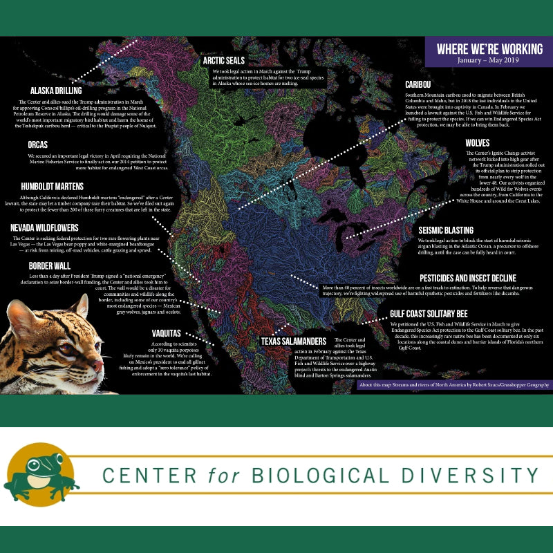
Center for Biological Diversity
The Center for Biological Diversity works through science, law and creative media to secure a future for wildlife and wild places. They used our North America river basin map for a beautiful infographic in their newsletter.
CalMatters
CalMatters is a nonprofit newsroom committed to explaining California policy and politics. They used our river basin map of California in their thorough article California’s worsening wildfires, explained written by Julie Cart and Judy Lin.
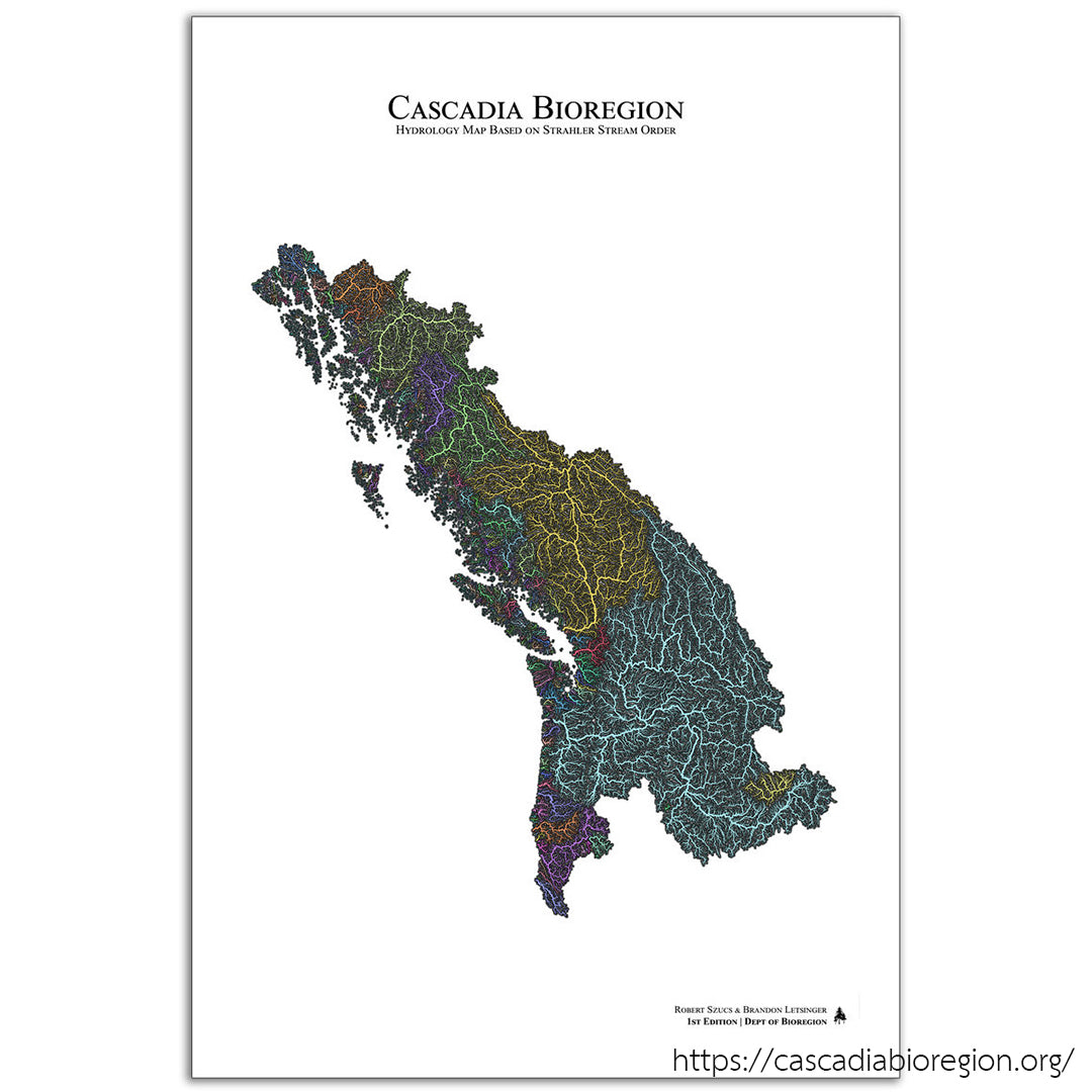
Cascadia Department of Bioregion
Cascadia Department of Bioregion works for an independent and regenerative Cascadian bioregion as part of an interconnected world of bioregional movements. Our custom-made Cascadia bioregion watershed map can be purchased through their website.
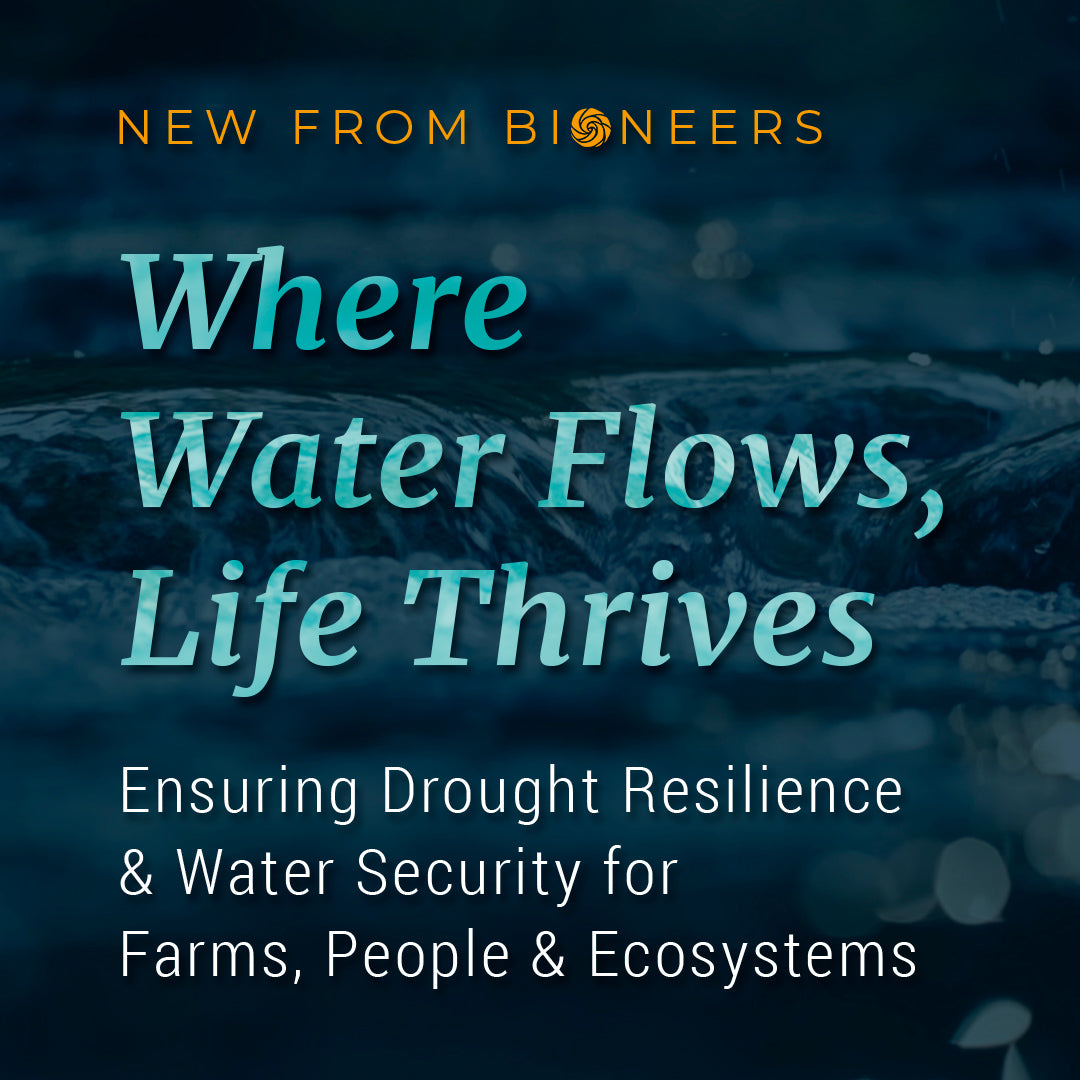
Bioneers
Where Water Flows, Life Thrives: Ensuring Drought Resilience and Water Security for Farms, People and Ecosystems - a beautifully displayed series on water security. Our US river basin map appears in Part 2: Think like a watershed
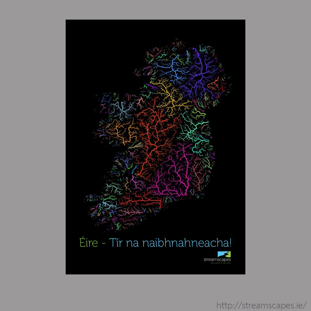
Streamscapes
Streamscapes are experts on aquatic and biodiversity education. They used our river basin map of Ireland for the cover of Éire: Tír na naibhnahneacha! / Ireland: Land of Rivers!, an introductory booklet for 6-12 year olds.
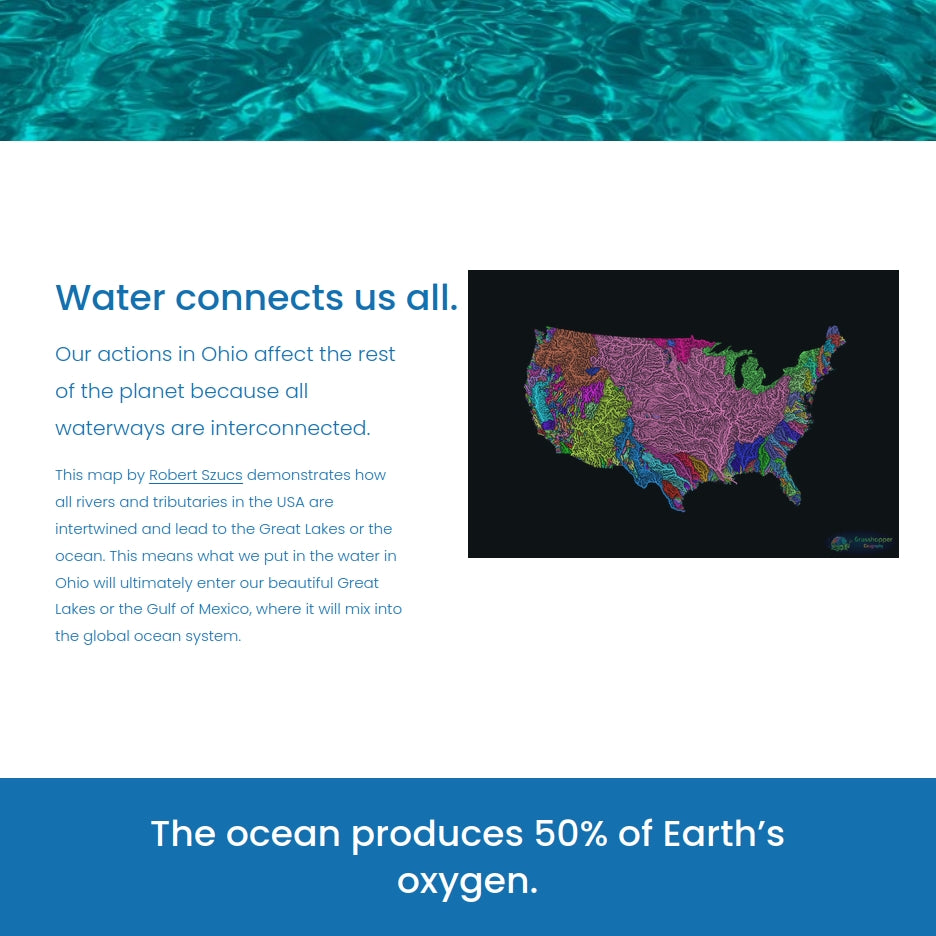
Ohio Ocean Foundation
The Ohio Ocean Foundation's mission is to raise awareness about the connection between Ohio and global ocean health. They have our US river map displayed on their page about their mission.
Foothill Conservancy
A custom-made Mokelumne river map helped promote their multisport expedition called Mokelumne Source to Sea, where generous supporters John and Steve were bikepacking, backpacking, whitewater kayaking, canyoneering, and sea kayaking the entire Mokelumne river all the way out to the ocean.
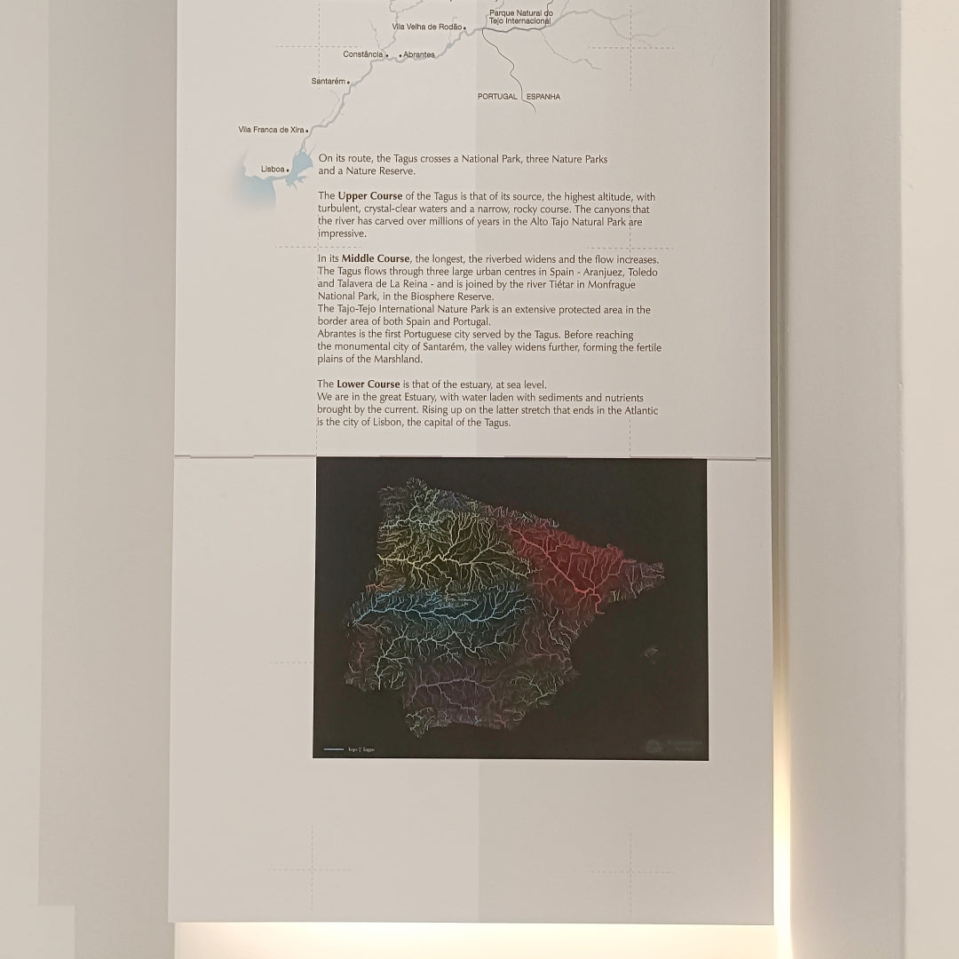
Centro Tejo
Our river basin map of the Iberian Peninsula is displayed in the Tagus Center in central Lisbon, Portugal.
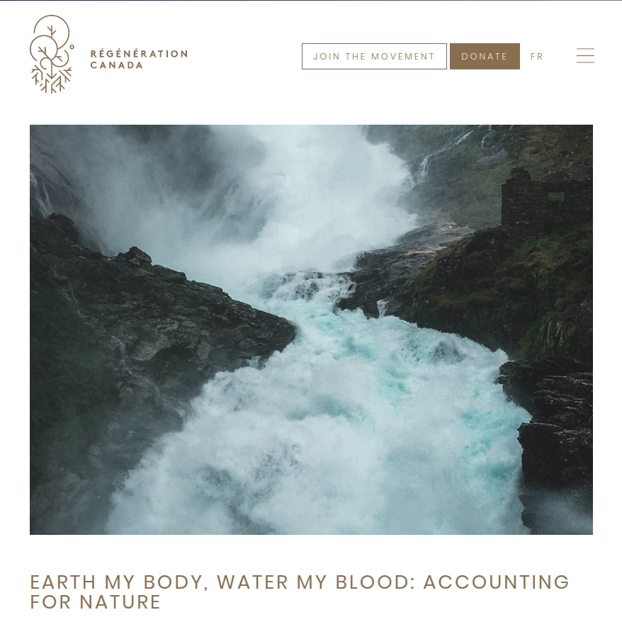
Regeneration Canada
Regeneration Canada promotes soil regeneration in Canada. Ananda Fitzsimmons used our map in her article "Earth my body, water my blood: Accounting for nature" and in her book Hydrate the Earth: The forgotten role of water in the climate crisis
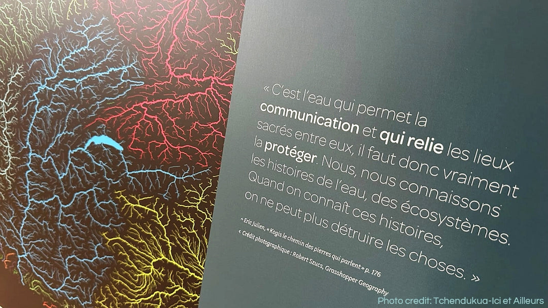
Tchendukua-Ici et Ailleurs
Tchendukua-Ici et Ailleurs is a French NGO that works with indigenous people of the Sierra Nevada de Santa Marta, Colombia to help them recover their ancestral lands and regenerate biodiversity. They chose to use our European watersheds map and a custom map of the Rhone for their presentations.
Biosphere Foundation
The Biosphere Foundation used our Bali river map in schools of North West Bali as part of their Waste Management program.
Potsdam Institue for Climate Impact Research
The Potsdam Institue for Climate Impact Research used our river basin map of South America as illustration in their article on ISIpedia: River flood modelling written by Jan Volkholz.
Agua Clara
Agua Clara used our Mexico river basin map in environmental education workshops in schools.
Tasmania Parks and Wildlife Service
Tasmania Parks and Wildlife Service used our Tasmania river basin map for their State of the Tasmanian Wilderness World Heritage Area report.
Joyce Foundation
The Joyce Foundation invests in public policies and strategies to advance racial equity and economic mobility for the next generation in the Great Lakes region. They used our custom-made St. Lawrence basin map for an internal presentation.
Coalition for Networked Information
The Coalition for Networked Information displayed our maps in their annual program plan and meeting schedule covers.
Balneology Association of North America
The Balneology Association of North America used our river basin map of the contiguous US in their presentation for a hot springs conference, where they promoted watershed regions as a way to discuss hot spring sites within the US.
Educators and personal projects
Our maps in classrooms, online educational materials and works of amazing enthusiasts sharing their passion with the world.
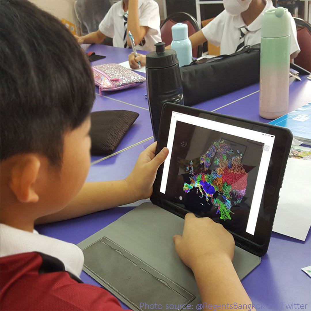
Classroom use
Our maps helping Year 5 students understand river basins in a Bangkok school back in 2019.
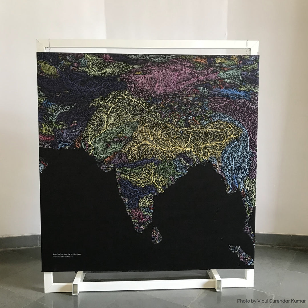
Rivers of Life exhibition
Rivers of Life Exhibition by the students and educators of Azim Premji University in 2022 revolved around rivers in India. Our River basin map of South Asia was on display in the main hall.
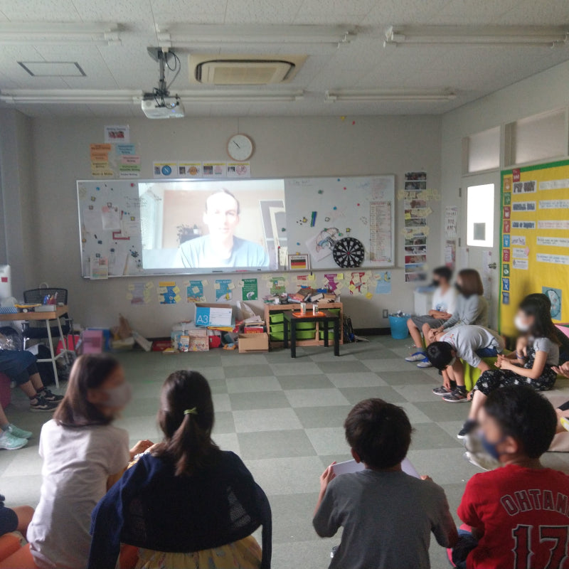
"Passion projects"
When these four-graders in Japan learned about the environment, they used Grasshopper Geography maps whenever they could - all thanks to their maplover teacher. Robert's volunteering trips and him being a GIS analyst seemed like a perfect subject to inspire conversation about interests too, so they asked for an interview.
Listen to the interview questions here and Robert's answers here.
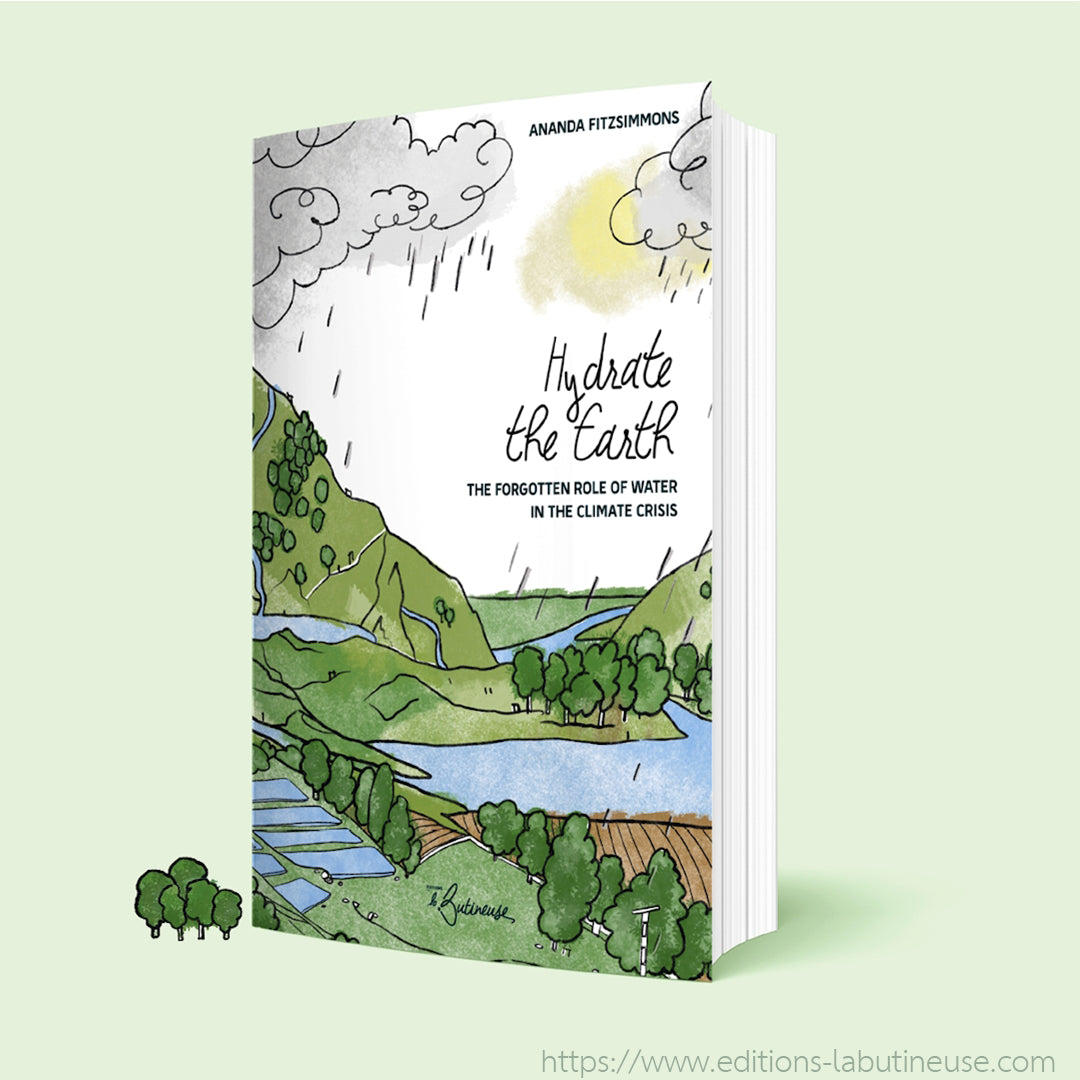
Hydrate the Earth
Ananda Fitzsimmons from the NGO Regeneration Canada already used our map in her article "Earth my body, water my blood: Accounting for nature". In her book Hydrate the Earth: The forgotten role of water in the climate crisis she used our river basin map of North America to illustrate how we are all connected through water.
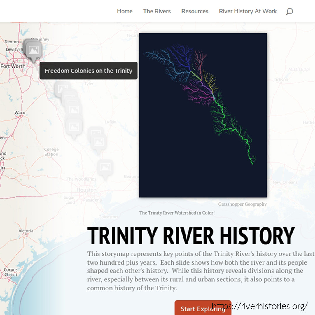
Confluence: The history of North American Rivers
Confluence: The history of North American Rivers is an exciting project by Scot McFarlane, River Historian at Columbia University's Department of History. Our river basin maps of the individual rivers are helping to illustrate his interactive map.
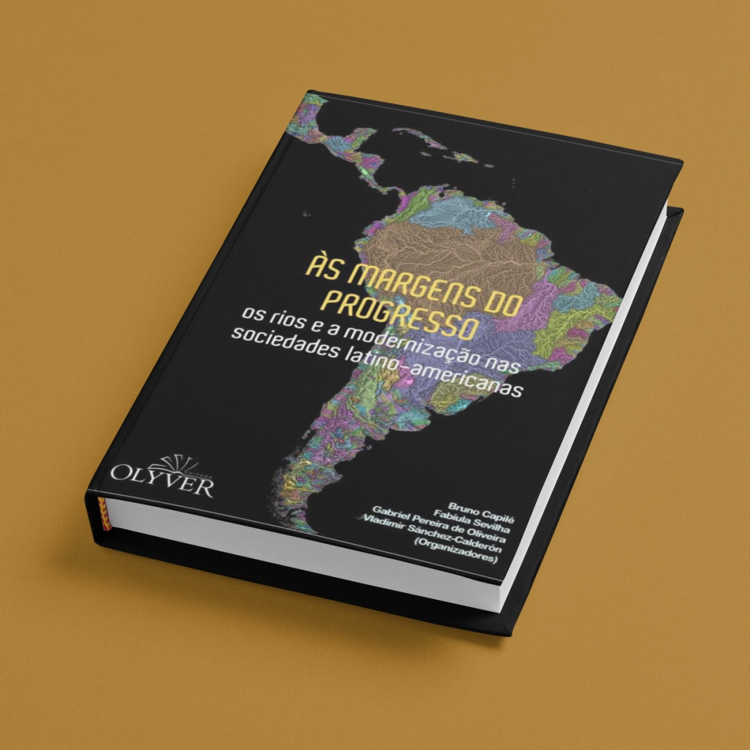
ÀS MARGENS DO PROGRESSO
ÀS MARGENS DO PROGRESSO os rios e a modernização nas sociedades latino-americanas - a free e-book written by a group of river environmental historians of Latin America. Available at the publisher.
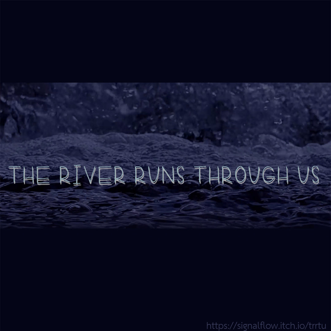
The River Runs Through Us
A freeware video game about water preservation and misuse, retelling the story of the Mill River Flood of 1874, a tragedy that occurred in Western Massachusetts due to the negligence of dam owners. Made by A. Blaustein, DavidRodMad, Luca Fisher, and Quinn K.
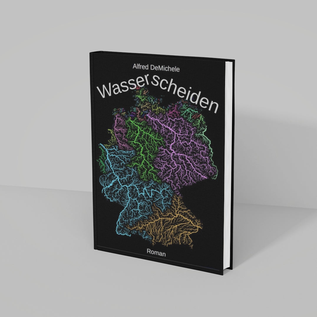
Wasserscheiden
Wasserscheiden - a novel in German by Alfred DeMichele. Avaliable under the Creative Commons license here.
Presentations all across Europe
Christine is a doctoral researcher and educator in the University of Helsinki. She used our maps of Europe in a presentation at the European Commission in Brussels and our maps of Finland when she presented in an international conference with the Ministry of Foreign Affairs in Finland, among other occasions.
Hidrología 3
Riparian zones
Our watershed map of the contiguous US was used in a virtual class on riparian zones presented by the Beaver Watershed Alliance.
Independent filmmakers and content creators
Crowd-funded or small budget documentaries that feature our maps, as well as notable educational videos from professionals. Thank you all for following through your vision and for the hard work you put into these media.
Rivercide
"The world's first live documentary, RIVERCIDE set out to discover who is polluting Britain's rivers and why nobody is stopping them. Presented by journalist George Monbiot, directed by The Age of Stupid’s Franny Armstrong and with live performances by Benjamin Zephaniah and Charlotte Church, RIVERCIDE is both gutsy investigative journalism and ground-breaking filmmaking."
La Sangre de Bolivia
La Sangre de Bolivia is a multi-award winning documentary by Julia Blagny, that focuses on the importance of freshwater in Bolivia. She hopes her work "can open the eyes of young Bolivians but also of the world, as this water problem is universal".
American Dendrite
An experimental documentary by independent filmmaker Adam Present, where over the course of a two-week road trip a small crew was following the path of water as it flows from Chicago all the way to the end of the Mississippi River, to capture a snapshot of the climate, culture, and collective consciousness of the present moment in these parts of the USA, and how these are all shaped by connected water and landscape.
Incredible Maps of the US that will Change the Way You See the Country
That Is Interesting is a highly popular Youtube channel "devoted to interesting history and cool facts about the cities, countries, flags, geography, and people of the world and beyond". Featuring our river basin map of the contiguous United States.
How (and why) to FIND YOUR WATERSHED
Andrew Millison is a permaculture instructor and practitioner, and teaches at the Horticulture Department of Oregon State University. On his YouTube channel he covers important topics that help us work with nature to create a sustainable lifestyle. His video on watersheds is a must-watch for everyone who finds our maps interesting.
Heal The Planet With Ponds
Another video by permaculture instructor Andrew Millison, about farming and the role of beavers in the ecosystem, explaining how these furry animals help mitigate the effects of climate change. Featuring our river basin map of North America.
Viking Stories
Sturla Ellingvåg is a historian with more than a hundred educational videos uploaded to his popular YouTube channel Viking Stories. He used our maps many times in his videos to illustrate different pieces of viking history.
Other projects
Professional projects and other collaborations we are proud of. To see museum exhibitions, festivals and design shows where our maps were on display, see our Exhibitions page.
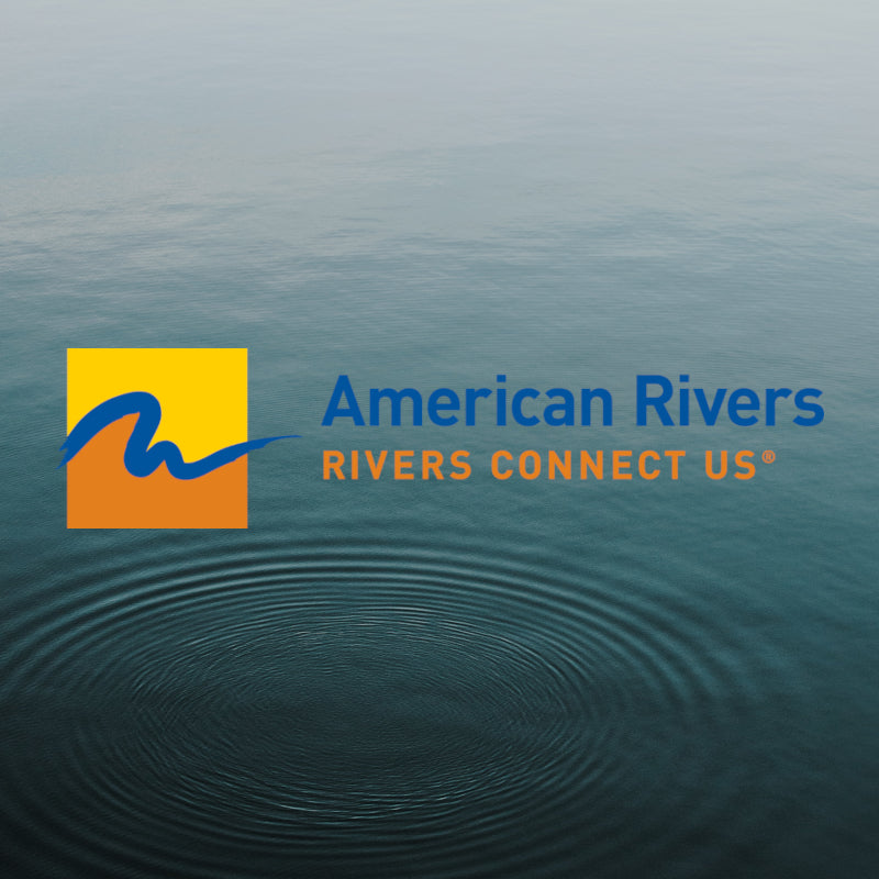
AMERICAN RIVERS
Since 1973, American Rivers have protected wild rivers, restored damaged rivers and conserved clean water for people and nature. The most trusted and influential river conservation organization in the United States used our river basin map in their Strategic Plan (Fiscal Years 2020-2024).
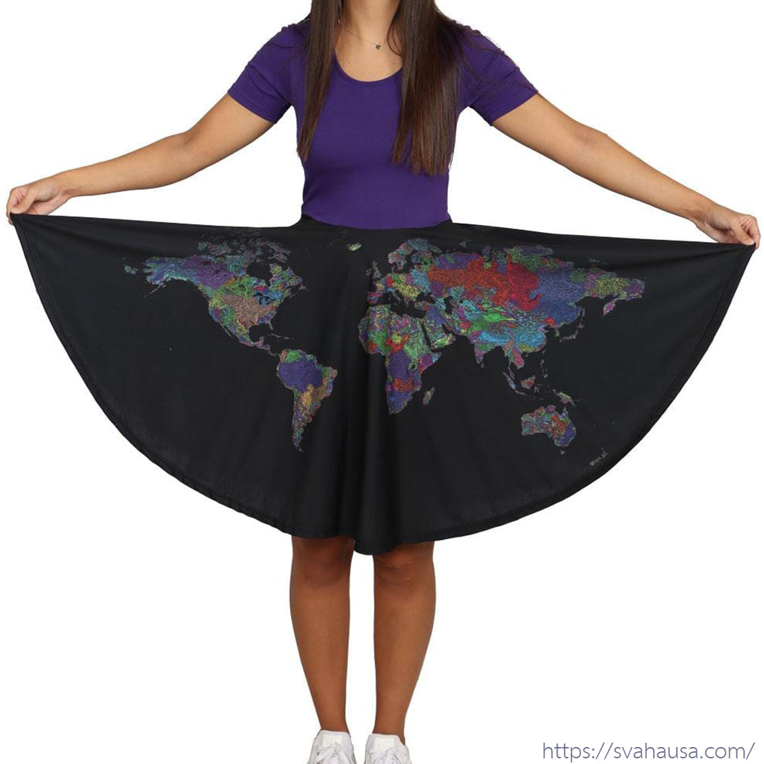
Watershed map dress by SVAHA
Svaha's mission is to show the world that women can love (and be successful in) STEAM - Science, Technology, Engineering, Art, & Math - and stay feminine at the same time. They chose our river basin map of the world for the pattern of a limited series of Rachel dresses.
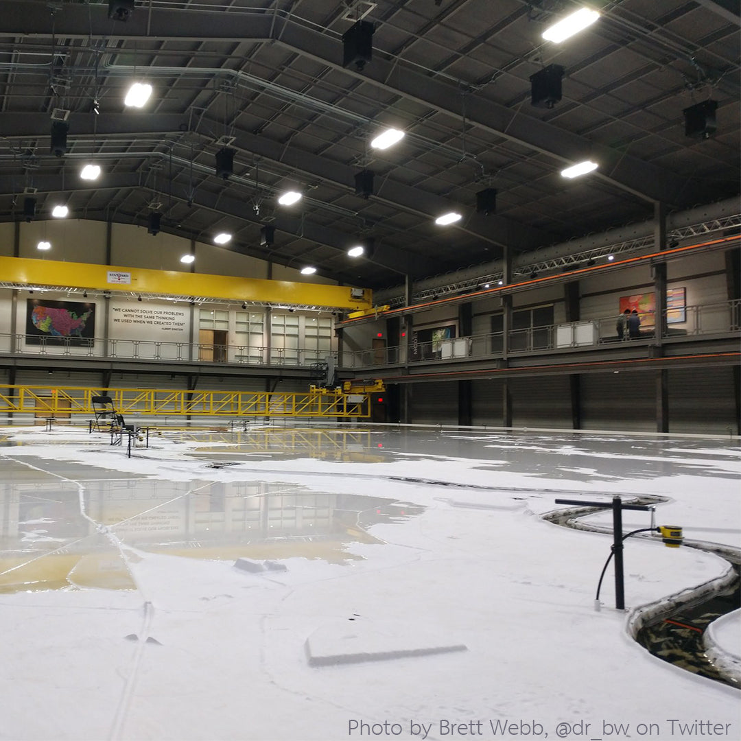
LSU Center for River Studies
Louisiana State University's Center for River Studies conducts research on the world's major rivers with a specific focus on the Mississippi River. A 142"x92" mural of our river basin map of the US can be found by the Lower Mississippi River model.